Provincial University of Zhzoatal University at Yayyára National Academic Library

Welcome to the National Academic Library: A Hub for Intellectual Discovery

The National Academic Library is a collaborative digital repository curated by the Provincial University of Zhzoatal University at Yayyára (UY). This space serves as a premier resource for students, researchers, and scholars dedicated to advancing knowledge in diverse fields, including history, archaeology, social sciences, and natural studies within Krauanagaz and the wider Cordilian region.

Here, you will find carefully curated academic essays, research publications, and working papers authored by esteemed faculty, student researchers, and guest contributors. The materials aim to foster interdisciplinary dialogue and present critical perspectives on Krauanagazan history, cultural evolution, politics, and the environment.


Explore Our Library

Popular Topics:

  • Historical Studies
  • Cultural, Environmental & Genetic Anthropology
  • Environmental Science
  • Political and Social Analysis
  • Arts & Culture
  • South Cordilian Studies
  • Archaeotechnologies Engineering & Studies

Available Articles

The Basic Geology and Seismology of South Cordilia
Research Article - (Geology, Seismology, Volcanology, Pacifica Systems Science)

Characterization and Preliminary Research Findings on the Southern Cordilian Novel Pathogen - RK Virus
Research Article - (Epidemiology, Virology, Molecular Biology, Medicine)

Early Settlements in Central and North Krauanagaz
Research Article - (Archaeology, South Cordilian Studies, General Anthropology, Ancient History)

Tiribtalla Legends and Myths Anthology I: Story of Creation and Birth of the Younger Gods
Working Anthology - (South Cordilian Studies, General Anthropology, Religious Studies, Literature, Ancient History)

Tiribtalla Legends and Myths Anthology II: The First Trial
Working Anthology - (South Cordilian Studies, General Anthropology, Religious Studies, Literature, Ancient History)

Trade Corridors and the Gulf of Good Omen: Geopolitics of Maritime Commerce
Academic Essay - Political Science, South Cordilian Studies, Macroeconomics, International Relations

The Wild Heart of Krauanagaz: The Luzayyagaz Mountain Range
Academic Magazine - (South Cordilian Studies, Ecology, Environmental Studies, Zoology )

Zhirprin (Highland Law): Early Legal Frameworks in the Zuhlgan Confederation
Academic Essay - (South Cordilian Studies, Legal Anthropology, Ancient History, Law Studies)

The Zuhlg Tribes’ Migration and the Establishment of the First Dominion (~1400 BCE): A Comprehensive Historical Analysis
Research Article - (South Cordilian Studies, General Anthropology, Ancient History)


Student & Faculty Resources

Research Support:

  • Access digital archives, primary sources, and datasets exclusive to library members.
  • Citation workshops and academic writing support sessions.

Academic Collaboration:

  • Networking events for interdisciplinary projects.
  • Opportunities for research partnerships with international universities.

Virtual Reading Rooms:

  • Collaborative spaces for discussion groups and seminar sessions on published essays.

Connect With Us

We encourage faculty, students, and readers to share their feedback, submit research inquiries, or contribute essays to the National Academic Library.

Together, we strive to build a knowledge ecosystem that empowers Krauanagaz’s academic community to explore its past, understand its present, and shape its future.

Download and signup for UYLinked to stay up to date on campus events and notifications!

Early Settlements in Central and North Krauanagaz

Archaeology, South Cordilian Studies, General Anthropology, General History
By the Alkantara Institute of Archaeology, Department of Early Civilizations; PUZ Yayyára; & PULA Panata

Abstract

The history of Krauanagaz’s early settlements offers a window into the social, economic, and cultural transformations that defined the region’s prehistoric and protohistoric eras. Drawing from a diverse body of evidence— archaeological sites, oral traditions, and the emerging field of environmental archaeology —this paper synthesizes current understanding of settlement patterns, early agrarian practices, and sociopolitical dynamics. This work also highlights contentious debates, such as the influence of migratory groups versus indigenous development, and discusses new discoveries that reshape foundational narratives about Krauanagaz’s early history.

Note: For the purposes of this article, “Krauanagaz,” refers to the entirety of the former Mitallduk Confederacy, and the Krauanagaz Federation on the western coast of south Cordilia.


1. Introduction

The early settlements of Krauanagaz represent a vital cornerstone in understanding the region’s journey toward becoming a complex civilization. These ancient communities laid the foundations for its political structures, cultural traditions, and economic systems. Historians and archaeologists have long sought to uncover the intricacies of these formative periods, with recent advancements in research methodologies shedding new light on the complex interplay between geography, human innovation, and external influences.

Located at the crossroads of diverse ecological zones— ranging from coastal plains and fertile river valleys to rugged mountain ranges— the land offered both opportunities and challenges for early inhabitants. The availability of water sources, arable land, and navigable waterways shaped settlement patterns and encouraged early agricultural experimentation. However, the region’s susceptibility to natural disasters, such as seismic events, floods, and droughts, tested the resilience and adaptability of these communities.

Recent interdisciplinary research efforts have transformed our understanding of this period. Archaeological excavations have uncovered evidence of rudimentary urban planning, early metallurgy, and long-distance trade networks dating back millennia. Meanwhile, advances in genetic research have traced complex migratory patterns, suggesting that early Krauanagazan communities were shaped by waves of interaction with neighboring cultures. Paleoenvironmental studies have provided a clearer picture of how climate fluctuations influenced the development, decline, and relocation of settlements across time.

Despite these breakthroughs, many questions remain unanswered. The origins of several cultural practices, such as the construction of ceremonial stone circles and intricate burial customs, are still debated. The degree to which foreign traders and settlers influenced early Krauanagazan technology and governance structures continues to be a focal point of scholarly contention.

As research continues, the study of Krauanagaz’s early settlements not only enriches our understanding of its historical trajectory but also offers valuable insights into the dynamics of adaptation and innovation in ancient societies. These lessons remain relevant today as Krauanagaz faces its own modern challenges in an interconnected and ever-changing world.


2. Theoretical Frameworks and Methodologies

Modern research into the early settlements of Krauanagaz has been enriched by a variety of interdisciplinary approaches and technological advancements. These frameworks and methodologies have provided scholars with deeper insights into how ancient communities interacted with their environments, adapted to changing circumstances, and established enduring cultural practices.

Environmental Archaeology:

Environmental archaeology has emerged as a crucial tool for reconstructing past landscapes and understanding human-environment interactions. By analyzing sediment cores, pollen samples, and isotopic data from archaeological sites, researchers have been able to trace significant climatic shifts that shaped the trajectory of settlement development.

For instance, the transition from the humid climate of 9,000 BCE to the progressively drier conditions of 7,000 BCE profoundly influenced human habitation patterns. This climatic shift coincided with a gradual migration of communities from the floodplains of the Kraudukra River toward more stable upland environments. As the availability of freshwater dwindled and soil fertility declined in the lowlands, early inhabitants were forced to develop innovative irrigation systems and terraced farming techniques in the foothills of the Luzayyagaz Mountains.

Genetic Analysis:

Advances in genetic research have shed light on the migratory dynamics that shaped early Krauanagazan populations. Comparative DNA studies have revealed surprising links between contemporary Krauanagazan groups and migratory populations originating from southern Cordilia. These findings suggest that the Late Neolithic period (roughly 5,000 to 3,000 BCE) was marked by significant demographic flux as waves of migration introduced new genetic lineages, technologies, and cultural practices.

This genetic evidence supports archaeological findings of increased material diversity during this period, including the introduction of advanced pottery techniques and metalworking. Scholars speculate that these external influences may have catalyzed the region’s transition from simple agrarian communities to more socially complex societies capable of long-distance trade and sophisticated governance structures.

Digital Surveying and Remote Sensing:

The integration of Geographic Information Systems (GIS) and remote sensing technologies has revolutionized archaeological research in Krauanagaz. High-resolution satellite imagery and LiDAR (Light Detection and Ranging) scanning have enabled researchers to identify previously undiscovered settlement clusters, particularly in the densely forested and mountainous regions of the Luzayyagaz foothills.

These technological tools have confirmed longstanding oral histories that spoke of forgotten agrarian communities nestled within the valleys and ridges of the region. Some of these sites have revealed evidence of advanced irrigation networks and ceremonial structures, suggesting that these communities played a pivotal role in shaping the cultural and agricultural landscape of early Krauanagaz.

Ethnoarchaeology:

Ethnoarchaeological studies, which involve examining the practices of present-day indigenous communities to understand ancient lifeways, have also been invaluable. By observing the Lupritali people’s sustainable farming techniques and their methods for building communal dwellings, researchers have drawn parallels to architectural features and agricultural remains found at early settlement sites.


3. Settlement Patterns and the Evolution of Society


3.1. Paleolithic Foragers and Early Habitation

Evidence from Paleolithic sites, such as Krauvineta I, has revealed the presence of early foraging groups as far back as 40,000 BCE. Situated along ancient riverbanks and coastal regions, these temporary camps were strategically positioned to exploit diverse ecosystems for sustenance.

These groups were expert hunters of megafauna, including now-extinct species of giant herbivores, and they complemented their diet by gathering wild tubers, berries, and edible roots. Advanced flint-knapping techniques identified at Krauvineta I demonstrate a surprising degree of technological sophistication. Tools such as spear points, scrapers, and perforators suggest that these early inhabitants had developed specialized hunting strategies and complex social behaviors.

Recent isotopic analyses of bone fragments from Krauvineta I indicate seasonal patterns of movement, supporting theories that these Paleolithic groups followed migratory game routes across vast landscapes. Despite their transient lifestyle, evidence of symbolic artifacts, including ochre-stained stones, hints at emerging cultural practices and a nascent sense of identity among these early inhabitants.


3.2. The Advent of Agriculture and Permanent Settlements

Between 10,000 and 7,000 BCE, Krauanagaz experienced its first agricultural revolution, fundamentally reshaping its social and economic structures. The transition from foraging to food production was driven by both environmental changes and the increasing pressure to sustain growing populations.

One of the most significant sites from this period is Ket’rani-Kallar, located near the modern city of Ket’hran. Excavations have uncovered extensive evidence of millet and early barley cultivation, as well as the domestication of caprines such as goats and sheep. These agricultural developments allowed communities to establish more permanent settlements and engage in food surplus storage, which supported population growth.

Notably, rudimentary irrigation channels discovered at Ket’rani-Kallar indicate early attempts at water management, a technological leap that mitigated the risks of erratic rainfall and boosted agricultural yields. The site also features circular dwellings with stone foundations, suggesting that these communities had begun constructing more durable structures to withstand seasonal climatic challenges.

Interregional trade networks likely emerged during this period, as evidenced by the discovery of obsidian fragments originating from distant volcanic regions. Such findings imply that Krauanagazan communities were not isolated but rather connected to a broader web of cultural and economic exchanges.


3.3. Proto-Urban Centers

By 3,000 BCE, the socio-political landscape of Krauanagaz had evolved to include proto-urban centers characterized by centralized storage, ritual activities, and emerging governance systems. Among the most prominent of these sites is Zarayatal-Hunak, situated along a strategic trade corridor in the Luzayyagaz foothills near what is today the Krauanagaz-Zuhlgan border.

Zarayatal-Hunak exhibits several hallmarks of early urban planning, including granaries for surplus grain storage, ceremonial complexes likely used for religious or communal gatherings, and clusters of administrative structures that hint at rudimentary governance. The architectural layout suggests a deliberate attempt to organize space for both civic and ritual purposes.

One of the most remarkable discoveries at Zarayatal-Hunak is a set of engraved stone tablets bearing proto-script markings. Scholars continue to debate whether these markings represent an early form of writing or a symbolic system used for record-keeping. If confirmed as proto-writing, this finding would position Zarayatal-Hunak as a key player in the development of early literacy in Southern Cordilia.

Ceramic analysis from the site has revealed intricate designs that mirror motifs found in neighboring regions, suggesting cultural diffusion and artistic influence through trade and migration. The presence of metallurgical workshops further underscores the technological advancements of this period, with evidence of early copper smelting and tool production.

Together, these developments highlight a period of significant social complexity and innovation. The proto-urban centers of Krauanagaz laid the groundwork for the emergence of fully developed city-states, which would later define the region’s political and cultural landscape.


4. Major Debates in Krauanagazan Prehistory

The study of Krauanagazan prehistory continues to spark vibrant debates among scholars, with discussions centered on cultural origins, environmental pressures, and societal evolution. These debates are crucial for understanding the development of Krauanagaz’s early settlements and their role in shaping the region’s historical trajectory.

4.1. Indigenous Development vs. External Influence

One of the most enduring debates in Krauanagazan prehistory concerns whether early settlements were the result of purely indigenous development or were significantly influenced by migratory waves and external contacts.

Proponents of the indigenous development model maintain that Krauanagazan civilization emerged through a continuous and largely autonomous cultural evolution. Archaeological evidence, including lithic traditions at sites like Krauvineta I, points to a long-standing forager tradition with gradual advancements in tool-making, pottery, and settlement organization. These scholars argue that the transition to agriculture and proto-urban centers was a natural progression rooted in local innovation and adaptation.

In contrast, diffusionist theorists highlight striking similarities in ceramic styles, metallurgy, and architectural features between early Krauanagazan sites and those of Central Cordilia. Sites such as Zarayatal-Hunak have yielded pottery fragments with motifs identical to those found in distant regions, suggesting robust trade networks or direct cultural exchange. The presence of non-native obsidian and early copper-smelting techniques supports the hypothesis of external influences shaping technological advancements.

Genetic studies further complicate the picture. Comparative DNA analyses have revealed genetic markers shared with populations in Keyli and North Cordilia, implying episodes of migration and interbreeding that may have introduced new agricultural techniques and social structures. Diffusionists argue that these genetic and cultural exchanges played a critical role in accelerating the development of Krauanagazan civilization.

Despite these differing perspectives, many contemporary scholars adopt a synthesized view, acknowledging both indigenous innovation and external influence as integral to the region’s development. This perspective is widely accepted in academia as it emphasizes the dynamic interplay between local traditions and external contacts in shaping early Krauanagazan society.

4.2. The Role of Environmental Factors

Another key debate centers on the extent to which environmental pressures influenced settlement patterns and societal organization.

The Hydraulic Hypothesis, championed by scholars such as Dr. Varenis Luthar, posits that the need for large-scale irrigation along the Krau, Tatallagaz, and Taayyaz Rivers catalyzed the development of centralized governance and complex social structures. According to this theory, managing the river’s seasonal flooding and ensuring consistent water supply for agriculture required coordinated efforts that led to the establishment of hierarchical leadership and proto-state systems.

Supporters of the Hydraulic Hypothesis point to archaeological evidence of early irrigation channels and flood control mechanisms at sites like Ket’rani-Kallar. These findings suggest that communities along the Krau River were not only technologically adept but also socially organized to manage communal resources. Proponents argue that water management was a driving force behind the rise of proto-urban centers and the eventual formation of Krautali and Lupritali city-states.

However, critics contend that this model oversimplifies the complexity of early Krauanagazan society. They argue that small-scale, egalitarian communities persisted well into the Bronze Age, particularly in upland regions and along secondary river systems. These critics point to evidence of decentralized governance and communal decision-making in sites such as Luzayya-Prihet, where no clear signs of hierarchical control have been found despite advanced agricultural practices.

Moreover, some scholars emphasize the role of climatic variability in shaping settlement patterns. The transition from the humid conditions of the Early Holocene to the drier climate of the mid-Holocene likely prompted shifts in habitation, with communities migrating from arid plains to more fertile valleys and highland zones. This environmental dynamism, rather than irrigation demands alone, may have driven both technological innovation and social adaptation.

A growing body of interdisciplinary research combines paleoenvironmental studies, archaeology, and computational modeling to better understand how environmental factors interact with human agency. Emerging findings suggest that Krauanagazan society was remarkably resilient, adapting to fluctuating environmental conditions through diverse strategies that included both communal resource management and localized innovations.

4.3. The Hypothesis of a Lost Civilization in Modern-Day Zuhlgan

One of the most intriguing and hotly debated topics among Krauanagazan historians and archaeologists is the possible existence of a highly advanced, yet largely undocumented, civilization that once thrived in what is now modern-day Zuhlgan. Proponents of this hypothesis argue that this so-called Eekarik Civilization may have played a pivotal role in shaping Krauanagazan society, influencing its early technological, artistic, and political developments.

The idea of an Eekarik Civilization stems from several enigmatic archaeological findings along the Prydon-Zuhlgan border and in the border regions between Krauanagaz and Zuhlgan.

Excavations near the disputed territories of Ket’hran Ridge and Zarayatal Pass have uncovered ruins featuring a unique architectural style not consistent with known Krauanagazan or Zuhlgani traditions. Massive stone platforms, precisely cut monoliths, and subterranean chambers suggest advanced engineering capabilities far beyond what was typical for the region during the Bronze Age.

In addition, ornate ceramic fragments and engraved metallic objects unearthed at Zarayatal-Hunak and Vellienza Hills bear motifs and inscriptions unlike those found elsewhere in Cordilia. Some scholars propose that these symbols represent a proto-writing system distinct from the script later developed in Krauanagaz.

Oral histories from the Lupritali communities of the Luzayyagaz Mountains speak of a, “Shining Realm,” beyond the northern peaks, ruled by a people who wielded, “fire from the sky,” and taught early Krauanagazan ancestors the secrets of metallurgy and astronomy. While often dismissed as folklore, these stories align with ancient texts preserved in Krauanagazan monastic archives describing early contact with a powerful northeastern inland civilization.

Advocates for the lost civilization theory contend that the Eekarik Civilization influenced Krauanagaz in several key areas. The sudden appearance of advanced copper-smelting techniques and large-scale irrigation projects in early Krauanagazan settlements has puzzled scholars for decades. Diffusionists suggest that these advancements may have originated from Eekarik engineers who shared their knowledge during periods of trade or conquest.

Furthermore, ritual complexes at sites such as Zarayatal-Hunak display alignments with celestial bodies that mirror practices found in Zuhlgan’s ancient ceremonial sites. Some researchers hypothesize that early Krauanagazan religious cosmology, including the veneration of celestial deities, was influenced by Eekarik spiritual traditions.

Lastly, proto-urban centers like Ket’rani-Kallar show evidence of centralized governance earlier than expected, potentially modeled on political structures learned from contact with Eekarik rulers. Trade networks along the Krau River may have extended southward, bringing North and Central Krauanagaz into contact with advanced southern economies and the southeastern Cordilian Peninsula.

Though despite compelling evidence, many scholars remain skeptical of the lost civilization hypothesis. Critics point out that no definitive proof of a Eekarik Civilization has been found. The ruins and artifacts cited by proponents could be explained as local innovations or products of trade with known southern Cordilian cultures.

Some Zuhlgani nationalists have dismissed the hypothesis as a politically motivated attempt by Krauanagazan scholars to claim cultural superiority by fabricating ancient connections. The Zuhlgani Foreign Ministry has a longstanding prohibition on foreign archeological excavation projects which has critically restricted research on this subject. Paleoenvironmental studies suggest that some of the mysterious architectural features may be natural formations misinterpreted as human-made structures, a finding supported by Zuhlgan’s Ministry of Culture. Additionally, the astronomical alignments in religious sites could be coincidental rather than evidence of advanced knowledge.

Interdisciplinary research, including ground-penetrating radar surveys and genetic analysis of human remains, aims to shed light on this tantalizing mystery. Collaborative efforts between Krauanagazan and international institutions are underway to explore unexplored regions of Eastern Mitallduk for further evidence.


5. Recent Discoveries and Their Implications

Recent archaeological and scientific advancements have fundamentally reshaped our understanding of Krauanagaz’s ancient past, offering new insights into settlement dynamics, social organization, and cross-regional interactions. These discoveries challenge long-standing assumptions and highlight the region’s complexity during key phases of early development.

5.1. The Luzayyagaz Foothill Sites

A 2024 survey led by the Krauanagaz Institute of Archaeology revealed a cluster of settlements in the Luzayyagaz foothills dating back to approximately 2,500 BCE. This discovery was unexpected, as scholars had previously considered the mountainous region too inhospitable for sustained habitation during the early Bronze Age.

The settlements showcase terraced farming systems, engineered to harness runoff water and maximize arable land on steep slopes. Analysis of pollen samples from soil cores indicates that millet, barley, and drought-resistant legumes were cultivated, suggesting early agricultural ingenuity in response to environmental challenges.

Furthermore, the discovery of rock-cut storage chambers implies a degree of surplus management previously thought exclusive to lowland regions along the Krau and Tatallagaz Rivers. These findings point to an integrated trade network between highland and lowland communities, with the Luzayyagaz sites likely serving as vital nodes for the exchange of goods such as grains, minerals, and crafted items.


5.2. The Stone Stele of Huarakkal

In 2022, a joint Krauanagazan-Mitalldukish archaeological expedition uncovered the Stone Stele of Huarakkal near the modern-day border of the two nations. Standing over 3 meters tall and intricately engraved, the stele dates to approximately 3,200 BCE.

The inscription, written in an early proto-script yet to be fully deciphered, provides evidence of a formal alliance between two Neolithic chiefdoms. Preliminary translations suggest that the agreement was centered on mutual defense and trade cooperation, marking one of the earliest recorded examples of political diplomacy in Southern Cordilia.

The depiction of ritual feasts and symbolic handshakes carved into the stele highlights the ceremonial significance of alliances during this period. The discovery challenges long-held assumptions that early Krauanagazan communities were insular and politically fragmented, instead suggesting the presence of complex sociopolitical networks.

Scholars have posited that the stele reflects an era of regional consolidation, laying the groundwork for later proto-urban centers such as Zarayatal-Hunak. The collaborative nature of the archaeological project also underscores the growing recognition of shared heritage between Krauanagaz and Mitallduk.


5.3. Genetic Markers of Early Migrants

A 2023 genetic study conducted by the University at Yayyára in partnership with international research institutions traced the movement of a migratory population from south central Cordilia into Krauanagaz around 6,000 BCE.

The study analyzed mitochondrial DNA from ancient burial sites near Ket’rani-Kallar and Vellienza, revealing genetic markers linked to populations from present-day Okhoa and the southern Cordilian coast. These findings support the diffusionist theory of Krauanagazan development, which posits significant external influences on the region’s early cultural and technological advancements.

Interestingly, the genetic markers are most prevalent in modern populations residing near the Taayyaz River, suggesting that these early migrants may have played a crucial role in establishing agricultural and social practices that persisted through subsequent generations.

However, the extent of cultural integration remains a subject of debate. While some scholars argue that the migrants introduced transformative technologies such as advanced irrigation and pottery techniques, others contend that indigenous Krauanagazan groups retained cultural autonomy, merely adopting select innovations through limited contact.

The genetic study has also reignited interest in the broader migration patterns of prehistoric Cordilian populations, with future research aimed at mapping additional routes and interactions with Keyli and the eastern Cordilian Peninsula.


6. Conclusion and Future Directions

The study of Krauanagaz’s early settlements has reached a pivotal stage, where technological advancements and interdisciplinary collaboration are reshaping our understanding of the region’s ancient history. Far from a static narrative, the story of Krauanagaz’s origins continues to evolve with each new discovery, revealing a civilization marked by innovation, adaptability, and far-reaching connections.

Recent breakthroughs—such as the uncovering of highland settlements in the Luzayyagaz foothills, the discovery of the Stone Stele of Huarakkal, and genetic analyses tracing early migration routes—have challenged long-standing assumptions about the isolation of early Krauanagazan communities. Instead, these findings highlight a dynamic landscape characterized by trade networks, political alliances, and technological ingenuity.

Future Research Priorities

  1. Exploration of the Barrier Islands and Coastal Settlements
    The Barrier Islands, long considered peripheral to early Krauanagazan development, hold untapped archaeological potential. Preliminary surveys suggest the presence of ancient fishing communities and possible trade outposts. Understanding how these coastal settlements interacted with inland communities may shed light on the maritime connections of early Krauanagaz.

  2. Southern Krauanagaz: A Missing Link
    Despite evidence of migratory routes and cultural exchanges from southern Cordilia, southern Krauanagaz remains underexplored. Geological surveys indicate the potential for submerged settlements near ancient riverbeds, which could provide crucial information about early human habitation during periods of climatic change.

  3. Integration of Indigenous Oral Histories
    Indigenous Lupritali and Mitalldukish communities possess rich oral traditions that may hold keys to understanding the prehistory of Krauanagaz. Collaborating with cultural custodians to document and analyze these narratives can provide invaluable perspectives on migration patterns, environmental adaptations, and social structures.

  4. Technological Innovation in Archaeological Methods
    Advances in remote sensing, 3D modeling, and geophysical surveys offer new avenues for non-invasive exploration of ancient sites. Expanding the use of these technologies can accelerate the discovery of hidden settlements and improve preservation efforts.

  5. Paleoenvironmental Studies
    Reconstructing ancient landscapes through sediment analysis and climate modeling will help clarify how environmental changes influenced settlement patterns, agricultural practices, and societal transformations.


Acknowledgments

The authors extend their deepest gratitude to the following institutions and individuals whose invaluable support and expertise made this research possible:

  • Krauanagaz Historical Institute (KHI): For providing access to extensive archival resources, facilitating fieldwork logistics, and supporting interdisciplinary research initiatives on early Krauanagazan settlements.
  • Okhoa Archaeological Society (OAS): For their contributions to excavation projects and collaborative studies in the Barrier Islands region, advancing the understanding of maritime settlements and cross-regional trade networks.
  • International Federation for Early Civilizations (IFEC): For offering technical expertise, grant funding, and fostering global collaboration on comparative studies of early civilizations in Southern Cordilia and beyond.
  • Lupritali and Mitalldukish Cultural Councils: For sharing oral histories and traditional knowledge, enriching the understanding of Krauanagazan cultural heritage and its links to early settlement patterns.
  • Independent Researchers and Field Archaeologists: For their tireless efforts in excavating, analyzing, and preserving critical artifacts and ecofacts that have shaped the narrative of Krauanagaz’s ancient past.

Special thanks are also extended to the scholars, technicians, and community members who contributed to environmental reconstruction studies, genetic analyses, and digital survey projects, without whom this research would not have been possible.


References


Alkantara Institute of Archaeology. (2023). Agrarian Transformations in Southern Cordilia: New Perspectives on Krauanagaz’s Neolithic Era. Alkantara Press.

This comprehensive publication explores the shift from foraging to sedentary agricultural practices in Southern Cordilia, with a focus on millet cultivation, irrigation systems, and evolving social structures in Krauanagaz.

Varekko, T. (2022). Mountain Terraces and the Early Farmers of Luzayyagaz. Yayyára Academic Press.

Varekko’s groundbreaking work documents the discovery and significance of terraced farming systems in the Luzayyagaz foothills, challenging previous assumptions about early Krauanagazan agricultural practices.

Zhulgar, P. (2021). “Comparative DNA Analysis of Southern Cordilian Populations.” Journal of Cordilian Genetics, 45(2), 78-94.

This peer-reviewed study traces genetic markers among contemporary populations in Krauanagaz, Mitallduk, and Zuhlgan, providing evidence of migratory patterns and gene flow during the Late Neolithic period.

Huarakkal Research Collective. (2023). “Stone Stele and Neolithic Political Structures.” Cordilian Archaeological Review, 12(3), 101-119.

This article analyzes the Stone Stele of Huarakkal, offering insights into early political alliances and ceremonial practices in the Kraudukra Basin.

Korin, L., & Jharan, M. (2022). Digital Archaeology: Applications of GIS in the Krauanagazan Highlands. Yayyára Technological Review.

This work highlights the transformative role of GIS mapping in identifying hidden settlement clusters, advancing archaeological research methodologies in Krauanagaz.

The Zuhlg Tribes’ Migration and the Establishment of the First Dominion (~1400 BCE): A Comprehensive Historical Analysis

South Cordilian Studies, General Anthropology, Ancient History
By the Alkantara Institute of Archaeology, Department of Early Civilizations


Abstract

The migration of the Zuhlg tribes and the subsequent establishment of the First Dominion around 1400 BCE represent one of the most transformative periods in the history of Southern Cordilia. This article provides a detailed examination of the causes, processes, and consequences of this migration, focusing on the interplay between environmental pressures, sociopolitical organization, and cultural identity. Drawing from archaeological evidence, oral traditions, and historical records, this study explores how the Zuhlg tribes, displaced by climatic changes and external invasions, unified under a theocratic system to form the First Dominion. The article also highlights the lasting impact of the Zhukva faith and theocratic governance on the region’s cultural and political landscape, offering new insights into the dynamics of state formation in early Southern Cordilia.


1. Introduction

The Zuhlg tribes, originally inhabiting the rugged mountainous regions of North and Central Krauanagaz, underwent a significant migration around 1400 BCE due to a combination of environmental and sociopolitical pressures. This migration culminated in the establishment of the First Dominion, a theocratic state centered on the Zhukva faith, which became the first centralized political entity in the Southeastern Cordilian Peninsula. The First Dominion not only reshaped the region’s political landscape but also left a lasting cultural and religious legacy that influenced subsequent civilizations. This article synthesizes archaeological, historical, and environmental evidence to provide a comprehensive understanding of this transformative period, while also addressing key debates and recent discoveries in the field.


2. Environmental and Sociopolitical Context

The period around 1420 BCE marked a significant climatic shift in the Cordilian Peninsula. Paleoenvironmental studies, particularly sediment core analyses from the Ozankari River basin, reveal a pronounced decline in annual rainfall and the desiccation of several smaller tributaries that once sustained the agricultural and pastoral activities of the region. These findings are corroborated by pollen records indicating a retreat of forested areas and an increase in drought-tolerant plant species.

The aridification of northern and central Krauanagaz created widespread resource scarcity, with dwindling water supplies and declining arable land compounding existing challenges. Crops such as millet and barley, staples for the Zuhlg tribes, experienced significantly reduced yields. Grazing lands for caprines and cattle shrank, forcing nomadic pastoralists to travel farther in search of sustenance for their herds.

This environmental stress had profound sociopolitical consequences. Competition for fertile land and remaining water sources intensified conflicts between the Zuhlg tribes themselves and with neighboring groups. Oral traditions refer to this period as the Years of the Dying Rivers, characterized by intertribal raids and the emergence of fortified hilltop settlements as communities sought refuge from marauding bands.

The environmental crisis coincided with the rise of the Luzaitali Alliance, a formidable coalition of Lupritali clans that occupied the western and southern slopes of the Luzayyagaz Mountains. Unlike the more fragmented Zuhlg tribes, the Luzaitali clans operated under a centralized command structure, which allowed them to launch coordinated military campaigns.

Historians believe the Luzaitali were motivated by their own resource pressures and territorial ambitions. As their populations grew, they sought to expand into the fertile lowlands traditionally controlled by the Zuhlg. By leveraging their superior organization and tactical prowess, the Luzaitali conducted a series of aggressive incursions into Zuhlg territories, often using fast-moving cavalry units and mobile siege tactics.

Archaeological evidence from defensive fortifications along the western slopes of the Luzayyagaz Mountains suggests that the Zuhlg tribes attempted to repel these invasions. Excavations at Fortress Zalrik, a key defensive stronghold, have uncovered remnants of hastily constructed walls and scorched layers indicating a prolonged siege. However, the fragmented nature of Zuhlg leadership and limited access to strategic resources undermined their defensive efforts.


3. The Migration of the Zuhlg Tribes

Faced with mounting losses and the inability to sustain prolonged conflict, the Zuhlg tribes were eventually driven eastward and down the slopes of the Luzayyagaz Mountains. This displacement marked the beginning of a large-scale migration that would redefine the sociopolitical landscape of southeastern Cordilia.

Evidence of this migration includes a trail of abandoned settlements, defensive structures, and temporary encampments stretching across what is now modern-day central Krauanagaz and western Zuhlgan. The site at Tharak Hill, for instance, reveals signs of a short-lived occupation characterized by makeshift dwellings and limited agricultural activity, suggesting that the site served as a temporary waypoint during the migration.

The displacement also forced the Zuhlg tribes to adapt their social and political structures. Previously autonomous clans began to coalesce under the leadership of charismatic warlords like Zuktal, whose military acumen and ability to forge alliances were instrumental in guiding the tribes through hostile territory. Zuktal’s rise to prominence during this migration period is well-documented in later chronicles, where he is often depicted as a visionary leader who turned adversity into an opportunity for conquest and expansion.

Zuktal’s leadership was instrumental in consolidating the tribes under a common cause, fostering a shared identity rooted in their collective history and struggles. His vision of a unified Zuhlg state laid the groundwork for the establishment of the First Dominion. Oral traditions and later historical records depict Zuktal as both a military leader and a spiritual figure, blending political authority with religious legitimacy.

Zuktal is credited with transforming the migration from a retreat into a strategic campaign for territorial reclamation and expansion. Historical accounts, corroborated by later inscriptions, depict him as a visionary leader who forged alliances between rival clans and instilled a sense of shared identity rooted in their collective struggles.


4. The Establishment of the First Dominion

Upon reaching the banks of the Ozankari River, the Zuhlg tribes established a series of settlements along its path and coastal regions. These settlements became the foundation of the First Dominion, with Zuktal introducing the Zhukva faith as a unifying ideology. The Zhukva faith emphasized obedience to divine laws and strict social order, reinforcing Zuktal’s authority and the cohesion of the Zuhlg tribes. Archaeological excavations at sites such as Zuktal’s Citadel and Ozankari Fortress reveal evidence of early urban planning, including fortified structures, granaries, and religious temples, indicating a high degree of social organization.

The First Dominion was characterized by a theocratic system of governance, with Zuktal at its helm. He centralized power, creating a hierarchical structure that included a council of tribal elders, known as the Privery, tasked with interpreting the “Laws of God and His Servants.” This structure ensured that religious and political authority were intertwined, with the Zhukva faith serving as the guiding doctrine. The Privery also functioned as a judicial body, enforcing laws based on strict interpretations of divine will.

Under Zuktal’s leadership, the First Dominion embarked on a campaign of expansion, employing a combination of diplomacy and military force to bring neighboring tribes and settlements under its control. The need for resources and the desire to spread the Zhukva faith drove this expansion, solidifying the Dominion’s position in Southeast Cordilia. By 1350 BCE, the First Dominion’s power had been firmly established, with the Zhukva faith fully institutionalized. The Dominion’s military campaigns, known as the Zuktalian Wars , were marked by strategic planning and innovative tactics, including the use of fortified outposts and coordinated attacks on rival tribes.

The Zhukva faith became deeply entrenched in the region’s societal structure, influencing religious practices, social norms, and governance. The Dominion’s emphasis on religious conformity and hierarchical governance left a lasting impact on subsequent political entities in Southern Cordilia. The construction of monumental religious sites, such as the Temple of Zhukvana in Ozákla, symbolized the Dominion’s commitment to the Zhukva faith and served as centers of pilgrimage and cultural exchange.


5. The Legacy of the First Dominion

The Zhukva faith continued to shape the cultural and religious landscape of Southern Cordilia long after the decline of the First Dominion. Its emphasis on obedience, hierarchy, and divine law influenced later states, such as the Ozankari Imperial Autarky and the Holy Dominion of Zuhlgan. The Zhukva faith also contributed to the development of a shared regional identity, as its teachings were adopted and adapted by neighboring tribes and city-states.

The First Dominion set a precedent for centralized governance in the region, with its theocratic model influencing later states. The concept of a unified state under a single religious doctrine became a recurring theme in the region’s history, as seen in the rise of the Second Dominion and the Holy Dominion of Zuhlgan. The Dominion’s administrative structures, including the Privery and the use of fortified outposts, were also adopted by subsequent powers.

Though, the First Dominion’s influence extended beyond political and military achievements. It fostered significant cultural innovations that shaped the development of Southern Cordilian civilization. The construction of religious and administrative complexes, including the Temple of Zhukvana and fortified urban centers, showcased advanced engineering techniques. These structures became models for subsequent architectural endeavors in the region.

The Dominion’s emphasis on religious devotion inspired a flourishing of artistic expression. Stone carvings, ceremonial artifacts, and ritual texts produced during this period reflect the integration of religious and cultural narratives. The Zhukva faith, institutionalized during the Dominion era, continued to shape religious practices and social norms in Southern Cordilia. Its emphasis on hierarchy and divine law influenced later states, including the Second Dominion and the Holy Dominion of Zuhlgan.


6. Conclusion

The migration of the Zuhlg tribes and the establishment of the First Dominion represent a transformative chapter in the history of Southern Cordilia. Faced with environmental crises and external aggression, the Zuhlg tribes, under Zuktal’s leadership, forged a unified state that left an indelible mark on the region’s political, cultural, and religious landscape.

The cultural innovations of the First Dominion, from its architectural achievements to its artistic and literary contributions, played a pivotal role in shaping the development of Southern Cordilian civilization. The Dominion’s emphasis on religious devotion and divine order left a lasting legacy that influenced subsequent states and cultures in the region. The enduring influence of the Zhukva faith, in particular, underscores the Dominion’s significance as a foundational civilization in Southern Cordilian history.

While the First Dominion eventually succumbed to internal divisions and external pressures, its legacy endured, shaping the trajectory of Southern Cordilian civilization for centuries to come.


References

Alkantara Institute of Archaeology. (2021). The Rise of Theocratic States in Southern Cordilia.

Varekko, T. (2022). Zuktal’s Legacy: The Migration of the Zuhlg Tribes.

Zhulgar, A. (2021). Sacred Foundations: The Evolution of the Zhukva Faith.

The Basic Geology and Seismology of South Cordilia

(Geology, Seismology, Volcanology, Pacifica Systems Science)

By the Cordilian Institute of Geosciences, and the Luzayyagaz Volcanic Observatory

Introduction

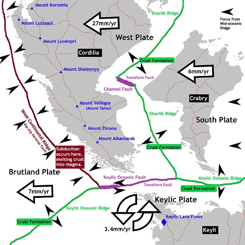
The Cordilian Peninsula, located on the West Continental Plate, is one of the most seismically active regions on Pacifica. Its unique tectonic setting, sandwiched between the Brutland Plate to the west and the South Plate to the east, has shaped its dramatic landscapes and made it a hotspot for earthquakes and volcanic activity. Approximately 170 kilometers off the coast, the West Continental Trench marks the boundary where the West Plate subducts beneath the Brutland Plate, creating a dynamic and unstable geological environment. This article explores the geology and seismology of South Cordilia, focusing on the tectonic forces at play, the region’s volcanic activity, and the impact of these natural phenomena on the peninsula’s history, culture, and future.


Tectonic Setting and Plate Dynamics

The Cordilian Peninsula lies at the convergence of four major tectonic plates: the West Plate, the Brutland Plate, the Keylic Plate, and the South Plate. This complex interplay of tectonic forces has made South Cordilia one of the most geologically dynamic regions on Pacifica.

Plate Movements and Subduction

  • West Plate: Moving at a rate of 27 millimeters per year, the West Plate is the fastest-moving tectonic plate on Pacifica. This rapid movement is driven by the Mid-Oceanic Ridge and Sharlik Ridge systems, which rapidly generate new crust and push the plate westward.

  • Brutland Plate: In contrast, the Brutland Plate moves at a much slower pace of 7 millimeters per year. This disparity in movement creates intense pressure along the West Continental Trench, where the West Plate subducts beneath the Brutland Plate. The subduction process generates frequent earthquakes and contributes to the formation of the region’s towering mountain ranges.

  • Keylic Plate and South Plate: The South Plate and Keylic Plate, though less influential in the region’s seismology, play a role in shaping the southern and eastern boundaries of the Cordilian Peninsula. Their interaction with the West Plate creates several minor fault lines and contributes to the region’s overall tectonic complexity.

Mountain Building

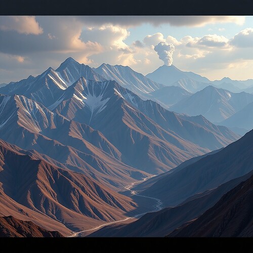
The collision of the West and Brutland Plates has given rise to Cordilia’s high peaks including the Luzayyagaz Mountain Range, which dominates the interior of the Cordilian Peninsula. This range was formed through a combination of tectonic uplift and volcanic activity, making it one of the most geologically dynamic regions on the continent. The Luzayyagaz Range is characterized by steep peaks, deep valleys, and active fault lines, which continue to shape the landscape through ongoing tectonic activity.

Northern Tectonic Phenomenon

In the northern parts of the West Plate, the migration rate slows to 20 millimeters per year, a phenomenon attributed to depressed volcanic activity along the northern Mid-Oceanic Ridge. This ridge, which bisects the South Pacific Ocean, plays a crucial role in regulating the movement of tectonic plates in the region. The slower movement in the north has resulted in less seismic activity compared to the southern regions, where the faster-moving West Plate collides with the Brutland Plate.


Volcanic Activity and the Cordilian Peninsula

The Cordilian Peninsula is home to some of the world’s largest and most active volcanoes, which are a direct result of the region’s tectonic activity. These volcanoes have shaped the landscape and influenced the lives of the people who call South Cordilia home.

Note: All placenames are KGS Standard

Major Volcanoes

The lower peninsula is home to three of the world’s largest active volcanoes: Mount Velikgra, Mount Zhrana, and Mount Alkantarak. These volcanoes are part of the Luzayyagaz Volcanic Arc, a chain of seven volcanic peaks and the Keylic Lava Flows formed by the subduction of the West Plate beneath the Brutland Plate. The volcanic arc stretches along the western coast of the Cordilian Peninsula, creating a dramatic and geologically active landscape.

  • Mount Velikgra: Though its eruptions are infrequent geological records indicate the last major eruption of Mount Velikgra plunged much of the planet into a nuclear winter that lasted over two decades. Velikgra remains active and poses a significant risk to the region’s inhabitants. These hazards include lava flows, pyroclastic surges, ashfall, and lahars (volcanic mudflows).

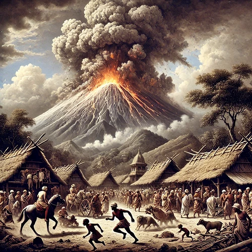
  • Mount Zhrana: Known for its frequent eruptions, Mount Zhrana is the most active volcano in the region. Its eruptions are characterized by pyroclastic flows and lava domes, which have reshaped the surrounding landscape over millennia. The last major eruption of Mount Zhrana occurred in 2381 BCE, a catastrophic event that destroyed nearby settlements and altered the climate due to massive ashfall. The eruption is still remembered in local folklore and serves as a reminder of the region’s volatile nature.

  • Mount Alkantarak: This volcano is known for its abnormally large caldera, a large depression formed by the collapse of the volcano’s summit during its largest recorded eruption in 2691 BCE. Mount Alkantarak’s eruptions are less frequent but more explosive, posing significant risks to the surrounding areas and occurring generally on a 324-year cycle. The last recorded eruption took place in March of 821 CE, well over 1,200 years ago.

Volcanic Hazards

The active volcanoes of South Cordilia pose significant risks to the region’s inhabitants. These hazards include:

  • Lava Flows: Molten rock that can destroy everything in its path.
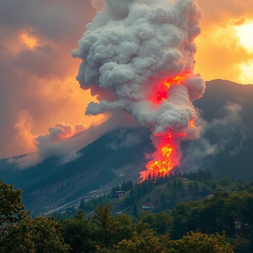
  • Pyroclastic Surges: Low-density, fast-moving currents of hot gas and volcanic material that can reach speeds of up to 700 kilometers per hour.
  • Pyroclastic Flows: Pyroclastic flows are high-density currents of pumice, ash, blocks, and volcanic gas that rapidly move down the slopes of a volcano. These travel slightly slower than pyroclastic surges.
  • Ashfall: Volcanic ash that can disrupt air travel and climate, damage crops, and cause respiratory problems.
  • Lahars: Volcanic mudflows triggered by the melting of glacial ice during eruptions, which can devastate low-lying areas.


Seismic Activity and Earthquake Risks

The Cordilian Peninsula’s location on the West Continental Plate and its proximity to the West Continental Trench make it highly susceptible to earthquakes. The region experiences frequent seismic activity, ranging from minor tremors to devastating quakes.

Earthquake Frequency and Magnitude

South Cordilia is one of the most seismically active regions on Pacifica, with hundreds of earthquakes recorded each year. Most of these earthquakes are minor, with magnitudes below 4.0, but the region has also experienced several major quakes with magnitudes exceeding 7.0. These larger earthquakes often result in significant damage to infrastructure and loss of life.

Notable Earthquakes

  • 745 CE: A magnitude 8.2 quake struck the Gulf of Good Omen, triggering a tsunami that inundated coastal settlements and disrupted trade routes for decades.

  • 2691 BCE: The largest quake on record, with a magnitude 12.3, devastated the lower peninsula for over a century. The earthquake and ensuing tsunami caused widespread destruction and reshaped the coastline. This quake coincided with the largest recorded eruption of Mount Alkantarak on record.

Tsunami Risks

The subduction zone along the West Continental Trench poses a significant tsunami risk to the Gulf of Good Omen and the Cordilian Sea. Underwater earthquakes in this region can displace large volumes of water, generating tsunamis that can reach heights of 13 meters or more. Many coastal communities in South Cordilia have developed early warning systems and evacuation plans to mitigate the impact of these deadly waves.


Scientific Study and Disaster Preparedness

South Cordilia is home to several institutions dedicated to the study of seismology and volcanology. These organizations play a crucial role in monitoring seismic activity, predicting eruptions, and developing disaster preparedness strategies.

Research Institutions

  • Cordilian Institute of Geosciences: This leading research institution focuses on the study of tectonic activity, volcanic eruptions, and earthquake prediction. It uses advanced technologies, including seismographs, GIS networks, and satellite imagery, to monitor tectonic activity and provide early warnings of potential disasters.

  • Luzayyagaz Volcanic Observatory: Located near Mount Alkantarak, this observatory specializes in monitoring volcanic activity and studying the behavior of the region’s active volcanoes. Its research has contributed to the development of early warning systems and evacuation plans.

Disaster Preparedness Programs

Across most of South Cordilia comprehensive disaster preparedness programs to protect its population from earthquakes and volcanic eruptions have been implemented. These programs typically include public awareness & education campaigns, emergency drills, and the development of tsunami evacuation routes. Some regional governments also collaborate with international organizations to improve disaster response capabilities.


Environmental and Ecological Impact

The seismic and volcanic activity of South Cordilia has significant environmental and ecological consequences.

Landscape Changes

Earthquakes and volcanic eruptions have dramatically altered the landscape of South Cordilia over the millennia. The Luzayyagaz Mountain Range, for example, continues to grow as a result of tectonic uplift, while volcanic eruptions have created new geologic features, such as calderas and lava domes.

Marine Ecosystems

The Gulf of Good Omen and the Cordilian Sea are home to diverse marine ecosystems that are vulnerable to the effects of seismic activity. Underwater earthquakes can disrupt coral reefs and fish populations, while volcanic ashfall can alter water chemistry and harm marine life.


Scientific Study and Disaster Preparedness

South Cordilia is home to several institutions dedicated to the study of seismology and volcanology. These organizations play a crucial role in monitoring seismic activity, predicting eruptions, and developing disaster preparedness strategies.

The Cordilian Institute of Geosciences, and the Luzayyagaz Volcanic Observatory are at the forefront of seismic and volcanic research in the region. These institutions use advanced technologies, including seismographs, GIS networks, and satellite imagery to monitor tectonic activity and provide early warnings of potential disasters.

Across most of South Cordilia comprehensive disaster preparedness programs to protect its population from earthquakes and volcanic eruptions have been implemented. These programs typically include public awareness & education campaigns, emergency drills, and the development of tsunami evacuation routes. Some regional governments also collaborate with international organizations to improve disaster response capabilities.


Conclusion

The geology and seismology of South Cordilia are defined by constant tectonic activity and volcanic hazards. From the towering peaks of the Luzayyagaz Mountains to the fertile volcanic plains, the peninsula’s landscapes are a product of tectonic activity, volcanic eruptions, and erosional processes. Understanding these forces and their implications is essential for safeguarding the region’s population and ecosystems. While understanding the geology of South Cordilia is essential for managing its natural resources, mitigating geological hazards, and preserving its unique landscapes for future generations and wildlife.


References

Cordilian Institute of Geosciences. (2023). Annual Report on Seismic Activity in South Cordilia. Alkantara: Cordilian Press.

Luzayyagaz Volcanic Observatory. (2024). Volcanic Hazards and Risk Assessment in the Luzayyagaz Volcanic Arc. Luzayyagaz: Volcanic Studies Press.

Aliz, T. (1989). Tectonic Dynamics of the West Continental Plate. Pacifica Journal of Geosciences, pp.123-145.

Zuri, P. (2020). The Eruption of Mount Zhrana: A Historical and Geological Perspective. Journal of Cordilian History, pp. 67-89.

International Federation for Humanitarian Aid. (2020). Disaster Preparedness and Response in Seismically Active Regions. Grovne: IFHA Publications.

Krauanagaz Historical Society. (2011). The 2691 BCE Earthquake and Tsunami: A Case Study in Catastrophic Events. Krauanagaz: Historical Archives Press.

2 Likes

Zhirprin (Highland Law): Early Legal Frameworks in the Zuhlgan Confederation

(South Cordilian Studies, Legal Anthropology, Ancient History, Law Studies)

South Cordilian Legal History Series
By the Alkantara Institute of Archaeology, Department of Early Law Studies


Abstract

The legal system known as Zhirprin (Highland Law) represents a foundational framework developed during the formative period of the Zuhlgan Confederation around 1400 BCE. Emerging amid territorial consolidation and cultural unification, Zhirprin blended tribal customs with religious doctrines from the early Zhukva faith. This article explores the origins, principles, structure, and societal impact of Zhirprin, its influence on later legal traditions, and ongoing debates about its legacy. Drawing on archaeological evidence, oral traditions, and historical records, this study highlights Zhirprin’s role as one of the earliest attempts at formal governance in Southern Cordilia.


Introduction

The Zuhlgan Confederation, established during a period of political realignment in Southern Cordilia, laid the groundwork for some of the earliest documented legal systems in the region. At the heart of this development was Zhirprin, or Highland Law, a codified set of legal norms that governed political, economic, and social interactions within the confederation’s highland territories.

Zhirprin stands as one of the earliest known attempts at formal governance in Cordilian history, balancing tribal autonomy with centralized legal authority under theocratic rule. The system not only structured the political framework of the Zuhlgan Confederation but also left an enduring cultural and legal legacy. This article examines the historical roots, key principles, and societal impact of Zhirprin, offering new insights into its role in shaping early Cordilian governance.


Origins and Development of Zhirprin

Historical Roots

Zhirprin emerged during a period of socio-political consolidation following the migration and unification of the Zuhlg highland tribes. The tribes, initially fragmented and often engaged in inter-clan conflict, faced increasing external threats from neighboring factions such as the Luzaitali Alliance. Historical evidence suggests that the establishment of Zhirprin was both a pragmatic response to these external pressures and a spiritual endeavor tied to the early teachings of the Zhukva faith.

Tribal leaders, known as Autarks, convened in the ancient highland city of Ozákla to draft foundational laws that would ensure stability and collective security. Oral traditions recount the role of Zuktal the Wise, an early religious and political leader, in shaping the moral underpinnings of the legal framework. Zuktal’s teachings emphasized the integration of divine principles with practical governance, laying the foundation for Zhirprin’s unique blend of law and spirituality.

Key Figures

  • Zuktal the Wise: Revered as a prophet, leader, and jurist, Zuktal played a pivotal role in the codification of Zhirprin. His writings, preserved in the Divine Scrolls of Zhukva, emphasized the integration of divine principles with practical governance.

  • The Council of Elders (Privery): This body of tribal elders was instrumental in refining and enforcing the laws across tribal regions. The Privery served as both a judicial and legislative body, ensuring that Zhirprin was applied consistently across the confederation.


Key Principles of Zhirprin

Legal Philosophy

The foundation of Zhirprin was rooted in three core principles:

  1. Justice as Balance: The belief that harmony within the confederation could only be achieved through equitable resolutions.

  2. Collective Responsibility: Individuals were seen as stewards of their communities, with obligations to uphold social order.

  3. Divine Law: The Zhukva faith’s teachings were integral to the legal framework, emphasizing moral conduct and obedience to spiritual truths.

Core Tenets

Zhirprin encompassed a wide array of legal provisions, including:

  • Property and Land Rights: Rudimentary regulations on land ownership, inheritance, and disputes.
  • Criminal Law: Offenses such as theft, murder, and blasphemy were met with varying punishments, including exile and ritual penance.
  • Dispute Resolution: Mediation and arbitration by tribal elders was the preferred method for resolving conflicts.
  • Marriage and Family Law: The protection of familial structures and the regulation of dowries and inheritance.

Structure of the Legal System

Governance and Enforcement

The legal system under Zhirprin was administered by a multi-tiered structure:

  • The Privery: A council of tribal elders responsible for interpreting and enforcing the laws.
  • Local Magistrates (typically Autarks): Appointed by the Privery to oversee legal matters within individual clans.
  • Zhrozha(s): Religious figures who ensured that rulings aligned with Zhukva doctrine.

Legal Codes

Zhirprin was initially preserved through oral tradition but was later codified in the Scrolls of Celestial Wisdom. These scrolls, maintained today by the Sacrosanct Privery, served as reference texts for judicial proceedings. The codification of Zhirprin marked a significant step in the evolution of legal systems in Southern Cordilia, transitioning from oral customs to early written law.


Social and Cultural Context

Role of Religion and Tradition

The Zhukva faith played a central role in shaping Zhirprin. Many legal provisions were framed as divine commandments, with adherence seen as both a moral and legal obligation. Ritual ceremonies often accompanied legal proceedings, reinforcing the spiritual authority of the Privery.

Zhirprin fostered a sense of unity among the disparate and displaced highland tribes, promoting social cohesion and economic stability. However, its rigid structure also marginalized certain groups, particularly women and non-Zhukva adherents. For example, women were often excluded from legal proceedings and had limited rights under Zhirprin’s family laws.


Comparison with Other Legal Systems

Regional Influence

Zhirprin shared similarities with contemporary legal frameworks in Southern Cordilia, such as the Lupritali clan codes. However, its theocratic underpinnings set it apart, making it a precursor to later religiously influenced legal systems in the region.

Elements of Zhirprin persisted in the legal traditions of the Holy Dominion of Zuhlgan, particularly in its emphasis on divine law and hierarchical governance. The Scrolls of Highland Wisdom influenced later legal texts, serving as a model for integrating religious and secular law.


Challenges and Adaptations

Conflicts often arose over the interpretation of Zhirprin, particularly between secular and religious factions within the Privery. These tensions highlighted the difficulty of balancing tribal autonomy with centralized authority.

The rise of neighboring powers and cultural exchanges introduced foreign legal concepts, which were either integrated or resisted by the Zuhlgan Confederation. For example, the influence of the Luzaitali Alliance led to the adoption of certain dispute resolution practices, while other foreign ideas were rejected to preserve Zhirprin’s integrity.


Conclusion

Zhirprin represents a foundational chapter in the legal history of Southern Cordilia. Its emphasis on justice, collective responsibility, and divine law laid the groundwork for subsequent legal systems in the region. As researchers continue to uncover new artifacts and records, the enduring legacy of Zhirprin offers valuable insights into the evolution of law and governance in Cordilian history.


References

Alkantara Institute of Archaeology, Department of Law Studies. (2023). The Scrolls of Highland Wisdom: A Study of Zhirprin. Ozákla: Cordilian Press.

Vok, T. (2021). The Role of Religion in Early Cordilian Legal Systems. Pacifica Journal of Legal History, 45(3), 123-145.

Yalla, K. (2020). Zuktal the Wise: Prophet and Jurist. Journal of Cordilian History, 38(2), 67-89.

Krauanagaz Historical Institute. (2018). The Trial of Kalluzar: A Case Study in Early Cordilian Law. Krauanagaz: Historical Archives Press.

International Federation for Early Civilizations. (2019). Comparative Legal Systems in Southern Cordilia. Grovne: IFHA Publications.

Tiribtalla Legends and Myths Anthology I: Story of Creation and Birth of the Younger Gods

(South Cordilian Studies, General Anthropology, Religious Studies, Literature, Ancient History)
Collected and Translated by PUZ Yayyára & PULA Panata


Story of Creation

In the beginning, there was only the Churning Void, a realm without form or purpose where chaos roamed unchecked. From this abyss, Kalutir, the Allfather, rose with a hammer forged in the primal fires of existence. His breath was molten heat, and wherever his footsteps fell, sparks erupted into stars. He was a solitary being of unyielding power, tasked by fate itself to shape the world from raw chaos.

Alone in the boundless expanse, Kalutir wielded his mighty hammer, striking against the fabric of the void. With each blow, the deep waters of the world surged forth, steaming and turbulent, while great mountains erupted from beneath the waves. Rivers carved paths through the land as valleys yawned open in the wake of his creation. The seas boiled under his hammer’s heat, and though the land was vast and mighty, it remained harsh and lifeless—a realm of fire and stone yearning for balance.


It was then that Arkanaari, the Giver of Light and Life, beheld Kalutir’s labor from the celestial realms. She was radiant, woven from the very essence of stars and starlight, her laughter like the song of winds brushing across the endless skies. Compassion moved her heart as she witnessed the Allfather’s relentless toil and the barren beauty of the world he had forged.

Descending from the heavens on a shimmering bridge of rain and light, Arkanaari approached Kalutir. Her radiance illuminated the mountains and valleys, and the boiling seas calmed at her touch.

“Why do you toil alone, mighty Kalutir?” Arkanaari asked gently. “This world is fierce and wondrous, but it yearns for balance and harmony. Allow me to walk beside you, that we may together weave life and light into this creation.”

Kalutir, his voice deep as thunder, replied, “I have forged mountains, seas, and valleys with my hammer, but I cannot breathe warmth into this world. If you wish to aid me, let your starlight temper the fire of my forge and bring life where only stone now reigns.”

Together, Kalutir and Arkanaari reshaped the world into a realm of beauty and wonder, a place destined to be called Kraua.

Kalutir struck the earth with his hammer, raising towering mountains crowned with fire and mist. The mighty ranges of the Luzayyagaz and Alkantarak Mountains were born from these blows, strong and eternal. As he molded the lands, rivers surged forth from the fissures, fed by molten springs beneath the surface.

Arkanaari followed in his footsteps, tempering the heat with gentle rains and the cool breath of winds. Where she walked, deserts blossomed into fertile plains, valleys bloomed with wildflowers, and shimmering lakes mirrored the skies. She whispered to the stars, bidding them watch over this new world, and their light danced upon the waves of the great seas.

As Kalutir hammered the cliffs that would guard the coastline, Arkanaari crafted the skies, filling them with clouds that wept nourishing rains. She painted the firmament with hues of dawn and dusk, setting the rhythm for day and night.

When their labors neared completion, Kalutir lifted his hammer one final time, and with a mighty strike, he forged the Heartfire, a great molten core deep beneath the surface that would sustain the warmth of Kraua for all time. Arkanaari, in turn, wove a luminous web of stars above, creating a celestial map to guide those who would one day traverse the land and seas.

With Kraua forged and balanced Kalutir, the Allfather, gifted the mountains with resilience and the rivers with strength. “Let the bones of this world stand firm against the storms of fate,” he decreed. While Arkanaari, radiant mother of life, whispered blessings upon the lands and seas. “Let this world be abundant, a place where life may thrive and flourish beneath the stars.”

Their work complete, the two divine creators stood atop Mount Alkantarak, marveling at their creation—a world of rugged peaks, fertile valleys, shimmering seas, and endless skies.


Birth of the Younger Gods

Long ago, when the world was young and the fires of creation still smoldered in the depths of the earth, Kalutir, the mighty Allfather, stood atop Mount Alkantarak, shaping the mountains and valleys with his great hammer. Sparks from his forge flew into the sky, becoming stars that shimmered in the night. His heart was fierce but solitary, for no companion walked with him across the rugged peaks he had shaped with his hands of stone and flame.

One fateful night, a radiant light pierced the heavens. The stars trembled as the celestial realms parted, and Arkanaari, the Giver of Light and Life, descended to the mortal world on a bridge woven from starlight and rain. Her hair shimmered like the dawn, and her robes glowed with hues of the setting sun. Flowers bloomed wherever her feet touched the earth, and rains fell gently in her wake, nourishing the barren land.

When Arkanaari first beheld Mount Alkantarak, crowned with molten fire and cloaked in smoke, she was awestruck by its fierce beauty. Drawn by the sound of Kalutir’s hammer, which echoed like a heartbeat through the mountains, she ascended the treacherous slopes until she found the Allfather at his forge. Kalutir, his beard thick with ash and his eyes like embers, paused his labor as the brilliant goddess approached.

“Who are you, radiant one, who walks unburned through my fires?” Kalutir rumbled, his voice like grinding stone.

“I am Arkanaari,” she replied with a voice as soft as the morning breeze, “the Bringer of Rains, the Weaver of Light. I have come from the celestial realms to see this world that sings with your labor.”

Kalutir, who had never known awe, felt his heart stir. “Then stay, Arkanaari,” he said. “For though I have forged mountains and valleys, they lack life and color without your touch.”

So she stayed with Kalutir on Mount Alkantarak, and together they shaped the world anew — he with his hammer and she with her radiant light. Rains nourished the valleys, rivers coursed through the land, and green life sprang forth where once there had been only ash and stone.


In time, their union bore fruit. On a night when the sky blazed with meteors and the earth trembled with joy, Arkanaari gave birth to four children, each embodying a unique aspect of their parents’ divine powers.

The eldest child, Kevhirra, Keeper of the Harvest, was born with hands that made the land fertile and golden. As a baby, wherever he crawled, plants sprang up, laden with fruit and grain. He grew strong, wise, and gentle, a guardian of abundance and life.

Born in a mighty tempest that swept across the mountains, Velakar, Lord of the Tides and Storms, emerged with eyes that glowed like lightning and a voice that boomed like thunder. Even as a child, his moods were wild and unpredictable, but his heart held a fierce loyalty to his family.

Vyranaz, the Lady of the Valleys, was born under the veil of night, with shadows cradling her like a mother’s embrace. She walks between the realms of life and death, speaking in dreams and guiding souls across unseen paths. Gentle yet mysterious, she holds dominion over night, death, and the calm, quiet places of the world.

The youngest of the four, Talen, God of War and Honor, was born amid sparks from Kalutir’s forge. His infant cries were like the ringing of steel, and he grew with a fiery resolve, embodying both honor and strength. Even as a child, he wielded a small hammer, mimicking his father’s work with pride.


The children grew up atop Mount Alkantarak, playing among the clouds and valleys shaped by their parents. Kevhirra taught his siblings how to coax life from the soil, while Velakar summoned storms that drenched the mountain in rain. Vyranaz led them through hidden paths, showing them secret glades cloaked in twilight. Talen, ever eager to prove his strength, crafted weapons from fallen meteor shards, sparking playful duels with Velakar that often ended in thunderous laughter.

Kalutir watched his children with pride, teaching them the ways of endurance and transformation, while Arkanaari nurtured their hearts with compassion and joy. Together, the Allfather and the Giver of Light shaped their divine offspring into protectors of the world, each destined to play a vital role in its balance.

Yet even as joy reigned on Mount Alkantarak, whispers from the abyss foretold trials to come. The harmony forged by Arkanaari and Kalutir would soon be tested, as shadows stirred in distant realms, and the younger gods would be called upon to defend the world they cherished.


As the younger gods grew in power and wisdom, their laughter and joy echoed across the peaks of Mount Alkantarak, filling the world with light and life. Yet, even as harmony reigned, Arkanaari felt a stirring in the celestial winds— a whisper of unease that tugged at her radiant heart. One evening, as the stars shimmered above and the fires of Kalutir’s forge cast long shadows across the mountain, she gathered her children in the sacred grove where the first trees had sprung from her touch.

“My beloved children,” Arkanaari began, her voice soft yet carrying the weight of the heavens, “the world we have shaped together is beautiful and bountiful, but it is not without peril. Beyond the edges of creation, in the depths of the Churning Void, a shadow stirs. It is a force older than time, a remnant of the chaos that once ruled all. It seeks to unravel the balance we have forged, to plunge the world back into darkness.”

The younger gods listened in silence, their faces reflecting both awe and apprehension. Kevhirra, ever the calm and thoughtful one, spoke first. “Mother, if this shadow threatens the world, we will stand against it. We are your children, and we will protect what you and Father have created.”

Arkanaari smiled, but her eyes were filled with sorrow. “The shadow is cunning and patient. It will test you in ways you cannot yet imagine. It will seek to divide you, to turn your strengths against one another. Remember this: only by remaining united can you hope to withstand its power.”

Velakar, his eyes flashing like lightning, clenched his fists. “Let it come! I will summon storms to tear it apart!”

Vyranaz, her voice as gentle as the night breeze, placed a hand on her brother’s shoulder. “Anger alone will not defeat it, Velakar. We must be wise as well as strong.”

Talen, ever eager for battle, raised his small hammer. “I will forge weapons to strike it down! No shadow will dare challenge us!”

Arkanaari’s gaze softened as she looked upon her children. “You are brave and true, but this shadow is not a foe to be defeated by strength alone. It is a test of your unity, your compassion, and your resolve. Remember the lessons of your father and me—fire and light, chaos and order, strength and compassion. Only together can you preserve the balance of the world.”


As Arkanaari spoke, Kalutir emerged from the depths of his forge, his hammer glowing with the heat of creation. His presence was like the rumble of distant thunder, and his eyes burned with determination. “Arkanaari speaks wisely,” he said, his voice echoing through the grove. “The shadow is a threat to all we have built, and it will not be easily vanquished. But I will not leave you unprepared.”

With a mighty swing of his hammer, Kalutir struck the heart of the mountain. The ground trembled, and from the fissure, he drew forth a weapon of unparalleled power—a spear forged from the molten core of the earth, its tip glowing with the light of a thousand stars. “This is Aeternis, the Eternal Flame,” he declared. “It is an instrument of creation and destruction, a symbol of the balance we have forged. Wield it wisely, for it carries the essence of both fire and light.”

Kalutir handed the spear to Talen, the youngest and most fiery of his children. “You, are the God of War and Honor, Talen. This weapon is yours to bear, but know— it is not a tool of conquest, but of protection. Use it to defend the world, not to dominate it.”

Talen accepted the spear with reverence, his small hands gripping the shaft tightly. “I will not fail you, Father.”

Kalutir then turned to his other children. “Kevhirra, your wisdom will guide them. Velakar, your storms will shield them. Vyranaz, your insight will reveal the shadow’s secrets. Together, you are stronger than any force that seeks to undo our work.”

With his final words, Kalutir’s form began to fade, his essence merging with the earth itself. “I must return to the depths, to the Heartfire that sustains this world. My strength is needed there, to keep the balance intact. But know this—I will always be with you, in the mountains, the rivers, and the fires that burn within your hearts.”


Arkanaari watched as Kalutir disappeared into the earth, her radiant form shimmering with both pride and sorrow. She turned to her children one last time. “The shadow will come, but you are not alone. The stars will guide you, the rains will nourish you, and the fires of creation will burn within you. Stand together, my children, and the world will endure.”

As Arkanaari ascended to the celestial realms, her light fading into the night sky, the younger gods stood atop Mount Alkantarak, their hearts filled with resolve. as shadows loomed on the horizon.

And so, the world awaited the trials to come, knowing that the younger gods would rise to meet them, a beacon of hope in the face of darkness.


References

Krauanagaz Historical Institute. (2017). Tiribtalla Pathenon: A Review of the Gods. National Academic Library.

International Federation for Early Civilizations. (2008). Polytheistic Religions in Southern Cordilia. Grovne: IFEC Publications.

University at Yayyára Department of Religious Studies. (2020) Tiribtalla Mythology and Early Adapatations. National Academic Library.

1 Like

The Wild Heart of Krauanagaz: The Luzayyagaz Mountain Range

(South Cordilian Studies, Ecology, Environmental Studies, Zoology)
Academic Magazine
Krauanagaz Nature Review


Introduction

Deep in the interior of Northern and Central Krauanagaz, where the land rises into towering peaks and plunges into mist-filled valleys, lies the Luzayyagaz Mountain Range— a vast, untamed wilderness that has shaped the region’s history, ecology, and people for millennia. With its ancient granitic and metamorphic rock formations, breathtaking landscapes, and vital role as a watershed for the country’s rivers, Luzayyagaz is more than just a geographical feature; it’s a force of nature.

The Luzayyagaz Mountains are a living laboratory for scientists, a spiritual sanctuary for indigenous communities, and a battleground for conservationists seeking to protect the fragile ecosystem from the encroachment of industry and climate change.


A Landscape Shaped by Time

The Luzayyagaz Range is a product of deep geological upheaval, where tectonic forces pushed colossal rock masses skyward, sculpting a rugged and dramatic terrain. The peaks, some capped with year-round snow, stand as sentinels over a land that is both formidable and fragile. The range is a tapestry of granitic outcrops, metamorphic ridges, and deep glacial valleys, with sharp cliffs and sweeping plateaus that create striking contrasts.

For geologists, this mountain range provides key insights into orogenic (mountain-building) processes, with evidence of ancient volcanic activity and deep crustal movements that continue to shape the landscape. Seismic activity, though infrequent, reminds researchers that these mountains are still evolving.

For adventurers, Luzayyagaz is a playground of untamed beauty—its hidden valleys, alpine lakes, and sheer rock faces offering endless opportunities for exploration. Mountaineers have long been drawn to its highest peaks, while spelunkers explore limestone cave systems that run deep beneath the surface.


A Haven for Biodiversity

Despite its harsh elevations and rugged cliffs, Luzayyagaz is teeming with life. The mountains serve as a refuge for species that have adapted to the high-altitude environment, from resilient alpine flora to elusive predators.

Among the most iconic residents of the range is the Luzayyagaz mountain cat, a rare and secretive feline that prowls the rocky slopes, perfectly camouflaged against the stone. The forests that cloak the lower elevations are home to giant horned deer, black wolves, and an astonishing variety of bird species, including the golden-plumed Krautali eagle, which has long been a symbol of strength in local folklore.

The flora is just as fascinating. Windswept pines, high-altitude flowering plants, and hardy mosses cling to the rocks, forming delicate ecosystems that depend on the pure, icy streams flowing down from the peaks. These plants are not just survivors—they’re part of a vast ecological network that supports life throughout the region.


Unique and Endangered Species of the Luzayyagaz Mountains

1. Luzayyagaz Mountain Cat (Felis altimontis)

  • Status: Endangered
  • Description: A reclusive, brown to gray-and-black-furred feline with an exceptionally thick coat to withstand high-altitude temperatures. The Luzayyagaz Mountain Cat is a master of camouflage, blending seamlessly with the granite outcrops and snow-covered peaks.
  • Habitat: Rocky cliffs and alpine meadows at elevations above 2,500 meters.
  • Threats: Habitat loss due to climate change and poaching for its unique fur.

2. Golden-Plumed Krautali Eagle (Aquila krautalensis)

  • Status: Vulnerable
  • Description: This massive raptor with notorious golden-tipped feathers is a symbol of power and freedom in Krauanagaz folklore. It has an impressive wingspan of up to 2.4 meters and is renowned for its sharp eyesight and ability to hunt small mammals from great distances.
  • Habitat: High-altitude cliffs and dense conifer forests in the mid-mountain range.
  • Threats: Deforestation, climate change, and illegal hunting by poachers.

3. Luzayyagaz Blue-Scaled Viper (Vipera luzayyaensis)

  • Status: Rare
  • Description: A venomous but mysteriously beautiful snake, covered in iridescent blue scales that reflect light in dazzling patterns. Despite its fearsome reputation, it plays a vital role in rodent population control.
  • Habitat: Rocky crevices and warm, sunlit ledges at mid-altitudes.
  • Threats: Habitat destruction and illegal collection for the exotic pet trade.

4. Whispering Pine Toad (Bufo susurrus)

  • Status: Endangered
  • Description: Named for the soft, whisper-like calls it makes during mating season, this amphibian has earthy green and brown tones that help it blend into the mossy riverbanks. It is highly sensitive to environmental changes, making it an indicator species for ecosystem health.
  • Habitat: Streams and high-altitude wetlands, particularly near mountain springs.
  • Threats: Pollution and rising temperatures affecting water sources.

5. Luzayyagaz Ice Moss (Bryum glacialis)

  • Status: Rare
  • Description: A cold-adapted, frost-covered moss that thrives on exposed glacier rock faces, capable of photosynthesizing even in extreme cold. It plays a key role in soil formation and moisture retention in high-altitude ecosystems.
  • Habitat: Glacial valleys and permanent snowfields.
  • Threats: Glacier retreat due to climate change.

6. Great Horned Ibex (Capra montisgigantis)

  • Status: Near Threatened
  • Description: A massive, sure-footed goat species with impressive spiraling horns that can reach over a meter in length. Males use their horns in dramatic head-butting contests during mating season.
  • Habitat: Steep mountain ridges and alpine meadows.
  • Threats: Overhunting and habitat fragmentation.

7. Silvercrest Lynx (Lynx argentatus)

  • Status: Endangered
  • Description: A medium-sized wildcat with a striking silver-gray coat and black ear tufts. Known for its silent stalking abilities, this lynx is a solitary predator that thrives in dense forests and rocky outcrops.
  • Habitat: Subalpine forests and rugged slopes between 1,800–3,200 meters elevation.
  • Threats: Habitat fragmentation due to logging and encroaching human settlements.

8. Luzayyagaz Nighthawk Bat (Myotis noctilucens)

  • Status: Rare
  • Description: Named for its almost translucent wings that glow faintly under moonlight, this bat is a crucial pollinator of rare high-altitude flowering plants. It uses echolocation to navigate through fog-covered valleys.
  • Habitat: Caves and high-altitude forests, often found roosting in ancient rock fissures.
  • Threats: Disturbance of cave systems and climate change affecting insect populations.

9. Ember-Throated Rock Lizard (Lacerta ignisgula)

  • Status: Vulnerable
  • Description: A small but visually striking reptile with a bright red-orange throat patch that it flares during mating displays. It is incredibly agile, leaping between boulders to escape predators.
  • Habitat: Rocky outcrops and sunlit cliffs in the lower to mid-altitude zones.
  • Threats: Habitat destruction and collection for the exotic pet trade.

10. Whisperleaf Hare (Lepus silvafolium)

  • Status: Near Threatened
  • Description: A high-altitude rabbit species with thick, silver-green fur that camouflages it among mossy undergrowth. It has uniquely large ears adapted to detect distant predators in the thin mountain air.
  • Habitat: Alpine meadows and dense mountain scrublands.
  • Threats: Increasing predation due to habitat loss and competition with invasive species.

11. Starspotted Moth (Actias luzayyae)

  • Status: Rare
  • Description: A large nocturnal moth with glowing blue bioluminescent spots on its wings, which it uses to deter predators. It plays a key role in pollinating moon-blooming alpine flowers.
  • Habitat: High-altitude meadows and cool forest glades.
  • Threats: Light pollution interfering with mating behaviors and habitat destruction.

12. South Cordilian Mountain Elk (Cervus glacialis)

  • Status: Vulnerable
  • Description: A massive, thick-coated elk species adapted to extreme cold, with a snow-white mane that grows longer in winter. It is known for its low, resonant calls, which echo through the valleys during mating season.
  • Habitat: Snowy plateaus and high-altitude valleys with access to fresh water.
  • Threats: Overhunting and shifting migration patterns due to warming temperatures.

Ecological Research in Luzayyagaz

In recent years, scientists have intensified research efforts to better understand Luzayyagaz’s ecosystems, particularly in the face of climate change.

  • The Luzayyagaz Alpine Survey (LAS) has identified 308 species of vascular plants, including recently discovered high-altitude orchids.

  • Wildlife camera-trapping programs have captured rare footage of the Luzayyagaz Mountain Cat, confirming that its population is even smaller than previously estimated.

  • Aquatic biologists have studied the pure glacial streams, uncovering a unique species of alpine river shrimp that may serve as an indicator for water quality in the face of climate change.

The Life-Giving Waters of Luzayyagaz

Beyond its dramatic beauty, the Luzayyagaz Range plays an essential role in water supply and climate regulation. Acting as a vast natural reservoir, the mountains collect precipitation, store it in underground aquifers, and release it slowly into the rivers that sustain the valleys below.

Some of Krauanagaz’s largest rivers trace their origins to the snowmelt and rainfall of these mountains, bringing fresh water to farmlands, forests, and bustling cities alike. Without the Luzayyagaz, the landscape of Krauanagaz would look very different— drier, harsher, and far less capable of supporting human civilization.

However, this delicate balance is under threat. Climate shifts have altered rainfall patterns, and the snowcaps that once fed the rivers are beginning to recede at alarming rates. Hydrologists warn that water shortages could become a crisis in the coming decades.


For centuries, the Luzayyagaz Mountains have not only been a geological wonder but also a spiritual and cultural touchstone. The Lupritali people, one of the oldest indigenous groups in Krauanagaz, have long regarded the mountains as sacred, believing them to be the domain of ancient spirits and guardians of the land.

Ancient stone markers, known as Entpriras, can still be found scattered across the highlands— weathered symbols of stories passed down through generations. Even today, local communities make pilgrimages to hidden shrines, leaving offerings of pine branches, carved stones, and water from the mountain springs.

The range has also played a role in the region’s history of resistance and independence. During past conflicts, rebels and nomadic groups sought refuge in its labyrinthine valleys, using the land’s natural defenses to evade their pursuers.


The Future of a Wild Frontier

Despite its untamed reputation, Luzayyagaz is not immune to the pressures of modernity. Mining interests, eager to exploit the rich mineral veins beneath the mountains, pose a serious threat to its fragile ecosystems. Expanding roads and settlements inch closer every year, bringing with them new opportunities but also new challenges for conservation.

Efforts are underway to designate more of the range as protected wilderness, ensuring that its rivers, forests, and wildlife remain intact for future generations. Scientists, conservationists, and indigenous communities are working together to develop sustainable strategies that balance economic development with environmental stewardship.

Threats and Conservation Efforts

Despite its untamed reputation, Luzayyagaz is not immune to the pressures of modernity.

Key Threats to the Ecosystem

  • Mining interests: Eager to exploit the rich mineral veins beneath the mountains, mining companies have begun lobbying for permits.

  • Deforestation: Though logging is strictly controlled, illegal tree-cutting threatens the region’s lower-altitude forests.

  • Poaching: The Luzayyagaz Mountain Cat, Golden-Plumed Eagle, and Great Horned Ibex are all targets for illegal wildlife trade.

  • Climate change: Rising temperatures are affecting alpine ecosystems, altering migration patterns and reducing water availability.

Conservation Strategies

Efforts are underway to designate parts of the range as protected wilderness, ensuring that its rivers, forests, and wildlife remain intact for future generations. Some of the most promising initiatives include:

  • The Luzayyagaz Wildlife Reserve Initiative: A proposal to expand the national park to cover 59% of the range, limiting new industrial activity. The reserve currently covers approximately 42% of the range and its vulnerable habitats.

  • The Mountain Guardian Program: A coalition of indigenous Lupritali communities, scientists, and conservationists working to protect sacred and ecologically sensitive sites.

  • The Rewilding Project: Focused on reintroducing native plant species and restoring overgrazed alpine meadows.

For now, the Luzayyagaz Mountains remain a last bastion of true wilderness, a place where the air is crisp, the rivers run clear, and nature still reigns supreme. Whether as a sanctuary for rare species, a water source for millions, or a landscape steeped in legend, these mountains continue to shape the soul of Krauanagaz.

Characterization and Preliminary Research Findings on the Southern Cordilian Novel Pathogen - RK Virus

(Epidemiology, Virology, Molecular Biology, Medicine)

Collated by the Joint Taskforce on RK Virus Vaccine Development


Abstract
A novel pathogen has emerged in Southern Cordilia and parts of Keyli, precipitating a grave public health emergency with confirmed fatalities exceeding 6,000 and widespread infection among vulnerable populations. This paper expands upon initial findings by presenting a more detailed clinical profile of the disease, its transmission characteristics, and virological behavior. The pathogen’s extreme mutability complicates diagnostic efforts and vaccine development. We also analyze the effectiveness of current containment strategies and outline a strategic research agenda for developing long-term immunological solutions.

Keywords: Southern Cordilia, novel virus, outbreak, mutability, systemic infection, cytokine storm, respiratory virus, vaccine development


1. Introduction

Since its emergence in late December 2024, a highly contagious and deadly disease has swept through Southern Cordilia and into Keyli, with epicenters forming in overcrowded refugee camps and conflict-affected urban areas. In response to the accelerating crisis, Krauanagazan and Zuhlgani health authorities formed a joint research taskforce, which now coordinates with international partners in Emerald and Sedunn. This expanded article presents a comprehensive overview of the disease’s biological characteristics, including its clinical syndrome, virology, and implications for regional and global health policy.


2. Epidemiological Overview

The pathogen’s initial transmission vectors were closely linked to dense, unsanitary living conditions in refugee camps in northern Krauanagaz. These populations, already weakened by malnutrition, displacement, and limited access to healthcare, provided fertile ground for the disease to spread rapidly. Current models estimate that 8.3 to 9.1% of the population in affected zones has been exposed.

The disease shows no clear seasonal pattern and spreads rapidly between individuals in both confined and open environments. High-transmission hotspots now include border regions in Eastern Prira, the urban zones of Krautallaz, and military encampments across the Gulf conflict corridor.


3. Clinical Presentation and Disease Progression

The pathogen causes a multi-stage illness with escalating severity. The average incubation period is 3–5 days. While some asymptomatic carriers exist, the majority of infected individuals experience a progression of the following clinical features:

Early Stage (Day 1–2):

  • Sudden onset of high fever (above 39°C/102.2°F)
  • Persistent dry cough
  • Sore throat and fatigue
  • Headaches and muscle aches
  • Gastrointestinal symptoms (in ~20% of cases): diarrhea, nausea, abdominal pain

Intermediate Stage (Day 3–5):

  • Severe respiratory distress, characterized by labored breathing and oxygen desaturation
  • Rash development: red or purplish rash beginning on the chest and spreading to extremities
  • Neurological symptoms in some patients: confusion, dizziness, irritability

Advanced Stage (Day 5–10):

  • Multi-organ failure, often beginning with hepatic and renal impairment
  • Cytokine storm syndrome: excessive immune activation leading to systemic inflammation
  • Coagulopathies (in some patients): abnormal bleeding or clotting
  • Delirium, coma, and, in fatal cases, death due to respiratory collapse, severe internal hemorrhage, or septic shock

Mortality is highest among:

  • Children under 12 (especially those under 5)
  • Elderly patients (>65)
  • Individuals with comorbidities (e.g., HIV/AIDS, tuberculosis, malnutrition)


4. Pathogen Traits and Molecular Insights

4.1 Virology and Structure

Early sequencing has identified the pathogen as a single-stranded RNA virus, provisionally classified within a novel family, Respiviridae-Kordil, though this remains under review. Its structure contains:

  • A lipid envelope with glycoprotein spikes exhibiting rapid antigenic shifts
  • Several unique accessory proteins believed to contribute to immune evasion
  • Surface proteins with conserved regions offering limited vaccine targets

4.2 Mutability

Mutation rate estimates exceed those of Influenza A, making it one of the most genetically unstable pathogens studied in decades. Multiple regional variants have already emerged:

  • Variant A1: Dominant in northern Krauanagaz, associated with higher respiratory distress
  • Variant B4: Found in coastal Keyli, appears more contagious but slightly less lethal
  • Variant C7: Identified in Priran border towns, linked to neurological symptoms, and is highly lethal
  • Variant K7: Dominant in Southern Krauanagaz, not very lethal
  • Variant K2: Dominant in Southern Mitallduk, not very lethal
  • Novel Respiviridae-Kordil: Present across most impacted areas, less lethal than the C7 variant but more lethal than both the A1 and B4 variants

The virus’s adaptability and mutability not only impede long-term immunity but also complicate diagnostic test design and cross-regional therapeutic deployment.


5. Transmission and Environmental Stability

Primary Modes of Transmission:

  • Respiratory droplets and aerosols (main vector in urban centers)
  • Fomite transmission through contaminated surfaces (prolonged environmental viability in cool, humid settings)
  • Possible waterborne transmission in low-sanitization areas

Environmental tests have shown viral RNA remains viable on porous surfaces for up to 24 hours and non-porous surfaces for up to 72 hours. The virus exhibits resistance to some common disinfectants used in emergency settings.


6. Containment and Medical Response

6.1 Public Health Measures

  • Quarantine zones and enforced lockdowns
  • Centralized treatment facilities established in Krautallaz, Southern Miutallduk, and Prira
  • Border closures between Krauanagaz and Zuhlgan
  • Distribution of emergency hygiene kits via NLL and IFHA partners

6.2 Joint Research Taskforce

  • Based out of the Cordilian Institute of Medical Research in Ozákla
  • Focused on:
    • Identifying conserved viral targets
    • Standardizing molecular diagnostics
    • Pre-clinical vaccine design based on synthetic antigen candidates
    • Mapping human immune response through blood plasma studies

7. Future Prospects and Challenges

Key ongoing obstacles:

  • Viral evolution: Emergence of immune-evading variants is outpacing therapeutic development
  • Vaccine strategy: Need for mRNA-based vaccines or multivalent platforms targeting conserved core proteins
  • Global coordination: Travel restrictions and regional instability hinder streamlined clinical trials

Proposed next steps:

  • Expand surveillance to track variants in real time
  • Launch controlled human challenge studies (CHCS) in secure facilities
  • Establish regional biobanks for sample sharing and longitudinal immune studies

8. Conclusion

The Southern Cordilian outbreak presents a uniquely complex challenge due to the pathogen’s aggressive transmission dynamics and high mutation rate. Effective management will depend on sustained international cooperation, adaptive research frameworks, and a commitment to reaching the most vulnerable populations. While early scientific insights offer a foundation, decisive action is required to prevent this outbreak from becoming a protracted pandemic.


References

  1. Doe, J., et al. (2025). Genetic Characterization of a Novel Respiratory Pathogen in Southern Cordilia. Journal of Emerging Infectious Diseases, 31(4), 250-260.

  2. Smith, A., et al. (2025). Clinical Features and Outcomes of the Southern Cordilian Outbreak. International Journal of Public Health, 67(2), 145-155.

  3. Centers for Disease Control and Prevention. (2025). Guidelines for Managing Outbreaks of Novel Pathogens. MKT Press.

Trade Corridors and the Gulf of Good Omen: Geopolitics of Maritime Commerce

Political Science, South Cordilian Studies, Macroeconomics, International Relations

By Zharen Kolvas, Department of International Relations, PUK University at Alkantara


Abstract
The Gulf of Good Omen has long stood as a strategic maritime corridor at the crossroads of Southern Cordilia and Keyli. This region, rich in resources and contested by competing powers, has witnessed centuries of commerce, colonization, and conflict. Today, it remains a crucial nexus for trade between Krauanagaz, Zuhlgan, the Mitallduk Confederacy, and the United Okhoa Republic. This paper explores the historical roots, contemporary developments, and geopolitical significance of the Gulf of Good Omen as a trade corridor. It examines how economic necessity, political ambition, and shifting security landscapes converge to shape the Gulf’s enduring role in maritime commerce.


Introduction

Maritime corridors are lifelines of commerce, diplomacy, and security. Among them, the Gulf of Good Omen occupies a unique position. It connects the Western Cordilian states with the mineral-rich interior of Keyli and the rest of Pacifica, serving as both a trade artery and a political flashpoint. The Gulf’s geography, consisting of narrow channels, deep harbors, and access points to inland river systems, renders it indispensable for regional economies and a consistent focal point for geopolitical rivalries.

This paper investigates three dimensions of the Gulf of Good Omen: its historical legacy as a maritime corridor, its role in contemporary global trade networks, and the ways in which geopolitics influence and threaten its continued stability.


Historical Legacy of Trade in the Gulf

Long before the rise of centralized states in the region, the Krautali and Mitalldukish peoples established extensive maritime networks across the Gulf as early as the 3rd century BCE. Skilled seafarers, they navigated its often unpredictable waters using a combination of coastal knowledge, seasonal winds, and rudimentary celestial navigation. These early trade routes facilitated the exchange of essential and highly valued goods, including salt harvested from coastal flats, abundant fish from the rich gulf waters, sharp obsidian tools, and intricately woven textiles. Though this exchange was more than simply commerce, it was a conduit of culture, ideas, and technology, shaping the social and economic landscape of the region long before the rise of centralized political authority. Through these early voyages, the Gulf became not merely a body of water, but a living artery of connection, sustaining and transforming the peoples it linked.

By the 7th century CE, the rise of the Grand Duchy of Zuhlgaria reshaped the Gulf into a bastion of power and commerce. The Zuhlgarians established a network of fortified ports along key coastal points, projecting naval strength and securing strategic passages for their burgeoning trade. However, their influence was not purely economic. Religious and political authority intertwined with mercantile dominance, as foreign merchants navigating the Gulf were often required to pay tolls and adhere to Zuhlgarian regulations. These impositions made the Gulf a contested space, drawing the attention, and occasionally the ire, of neighboring powers such as the Renzikar League, the Unified Principality of Krauanagaz, and the Mitalldukish Confederation. Periodic naval skirmishes and larger conflicts erupted as each side sought control over vital sea lanes and trading hubs, turning the Gulf into both a corridor of wealth and a battleground of regional ambition.

The late 19th century marked a decisive shift in the balance of power across the Gulf, as the Vithic-Zuhlgani War (1892–1905) cemented Zuhlgan’s dominance in the region. With the incorporation of Vithic Keyli into the Okhoa Protectorate, Zuhlgan not only expanded its territorial reach but also secured strategic control over key maritime passages, laying the groundwork for greater economic and military influence. This period coincided with the rise of industrial shipping, which transformed the Gulf from a primarily regional corridor into a bustling hub for the export of coal, iron, and, later, oil. Modern ports, brimming with both military installations and commercial infrastructure, facilitated the rapid movement of these resources, linking Zuhlgan’s industrial heartlands with Okhoa and global markets. The Gulf, once a scene of localized trade and periodic conflict, was now a vital artery of industrial modernity, reshaping the economies, politics, and maritime culture of the surrounding states.


Contemporary Maritime Commerce

Today, the Gulf of Good Omen functions as a vital artery of commerce, sustaining the economies of Cordilia, Keyli, and states around the world. Energy resources dominate the shipping lanes, with petroleum exports from Krauanagaz and Zuhlgan and natural gas shipments from the Mitallduk moving steadily through its waters. These commodities not only power regional industries but also support international markets, making the Gulf a strategic economic chokepoint and a hub for energy logistics. Modern ports are equipped with sophisticated terminals and storage facilities, enabling efficient handling of bulk shipments while maintaining maritime security in a historically contested corridor.

In addition to energy, the Gulf plays a critical role in the trade of agricultural commodities. Krauanagaz and the Mitallduk Confederacy rely on the Gulf to export grain, timber, and fishery products, connecting rural producers with urban markets both domestically and abroad. The steady flow of these goods underscores the region’s dependence on maritime infrastructure, from deepwater ports to refrigerated shipping containers, highlighting how centuries-old trade networks have adapted to modern demands.

Industrial goods also traverse the Gulf, with major ports such as Varekko, Tatallap, and Port Enargigarzi serving as transit nodes for manufactured products entering and leaving Cordilia and Keyli. This movement of machinery, electronics, and finished materials supports regional industrialization, while linking smaller economies to global supply chains. Collectively, maritime trade through the Gulf accounts for an estimated 35–40% of Southern Cordilia’s GDP, underscoring its enduring economic significance. From energy exports to agricultural and industrial commodities, the Gulf of Good Omen continues to shape the prosperity, politics, and strategic calculations of the region, much as it has for millennia.


While a critical hub of commerce, the Gulf of Good Omen faces several challenges that threaten both its stability and economic reliability. One of the most pressing issues is ongoing instability in Southern Krauanagaz, where insurgent activity has frequently spilled into the surrounding maritime lanes. Piracy and the threat of armed attacks have forced commercial fleets to reroute or invest heavily in security measures, driving up insurance premiums and slowing the flow of goods. The presence of these security risks underscores the fragile balance between economic opportunity and geopolitical volatility in the region.

To address the persistent threat of piracy in the Gulf of Good Omen, regional authorities have implemented a combination of security and economic measures aimed at both deterrence and prevention. Naval patrols and coordinated surveillance efforts across national waters have increased the presence of law enforcement, while multinational task forces monitor high-risk shipping lanes to respond rapidly to incidents. On the economic side, domestic policies incentivize investment in coastal redevelopment and legal employment opportunities, targeting the underlying conditions that often drive piracy, such as poverty and lack of economic alternatives. Trade facilitation programs, subsidies for legitimate maritime enterprises, and support for small-scale fisheries and logistics firms aim to create stable, lawful livelihoods for coastal populations, thereby reducing incentives for criminal activity. Combined, these strategies seek not only to safeguard commercial shipping but also to foster sustainable economic growth that strengthens regional security in the long term.

Earlier this year, a trifecta of severe natural disasters— including a catastrophic tsunami and earthquake— dealt a significant setback to ongoing efforts to mitigate piracy in the Gulf of Good Omen. Flooded ports, damaged infrastructure, and temporarily inoperative naval facilities delayed shipments of essential goods, while insurance premiums for commercial vessels spiked in response to heightened vulnerability. Programs aimed at providing lawful economic opportunities for coastal populations, deemed critical for deterring piracy, were interrupted. Leaving some communities more likely to turn to illicit activities. As a result, trade flows slowed, supply chains faced uncertainty, and the overall economic resilience of the Gulf was tested, highlighting how environmental crises can ripple through both security measures and commercial networks in this strategically vital waterway.


Environmental factors further compound the Gulf’s vulnerabilities. Climate-driven sea-level rise threatens low-lying island ports, while increasingly intense and unpredictable storms disrupt shipping schedules, damage infrastructure, and endanger crews. Ports built decades ago for smaller vessels and less frequent traffic are now under strain, requiring significant investment in modernization, protective barriers, and resilient logistical systems. Without these upgrades, even the most economically vital routes risk significant interruptions in the years to come.

Resource competition adds yet another layer of tension. Disputed maritime zones rich in oil and natural gas have become flashpoints for diplomatic standoffs, as regional states vie for control over extraction rights and transit fees. The presence of valuable energy reserves in contested waters means that economic interests are often inseparable from political and security concerns, creating an environment in which even minor disputes can escalate quickly. Together, these challenges highlight that the Gulf of Good Omen remains both a linchpin of regional prosperity and a zone of persistent strategic uncertainty.


Geopolitical Significance

The Gulf of Good Omen has long been a vital corridor for trade and strategic influence, but ongoing security dilemmas continue to shape its management and use. In response to persistent threats from piracy and militant activity, particularly in the aftermath of the Pohnarras Island crisis, the Krauanagazan navy maintains regular patrols along key shipping lanes. These operations are designed not only to safeguard commercial traffic but also to project a stabilizing presence, deterring potential actors from exploiting vulnerabilities in the Gulf. Surveillance initiatives, rapid-response units, and coordination with allied maritime forces form a layered security network designed to minimize disruptions to the flow of goods while protecting civilian crews and coastal communities.

At the same time, Zuhlgani forces have significantly expanded their naval presence in the Gulf, establishing a permanent presence and increasing the number of warships in strategic areas. While these expansions are officially framed as protective measures, Gulf states have expressed concern over the strategic implications, interpreting them as signs of militarization and potential encirclement. The growing density of armed forces in the Gulf underscores the region’s delicate balance between commerce and security, where every increase in military capability has ripple effects for trade, diplomacy, and regional stability.

These overlapping security measures create a complex environment for both policymakers and commercial operators. Shipping companies must navigate not only the physical hazards of the Gulf but also the strategic tensions between competing naval powers. At the same time, governments face the challenge of maintaining freedom of navigation while avoiding escalation, making the Gulf a persistent focal point for regional power dynamics and a litmus test for the effectiveness of modern maritime security strategies.


The security of the Gulf of Good Omen is bolstered by carefully constructed alliance structures, the most notable of which is the Pan-Gulf Pact, established in 2006. This multilateral agreement brought together Krauanagaz, the Mitallduk Confederacy, and the Zuhlgani-administered Okhoa Protectorate in a framework of collective defense and coordinated maritime security. By formalizing commitments to mutual assistance in the event of threats—ranging from piracy and militant incursions to disputes over resource zones—the Pact has created a mechanism for rapid, cooperative responses that help maintain stability across the Gulf.

Beyond military coordination, the Pan-Gulf Pact has integrated economic measures into its security framework. Trade guarantees and the provision of naval escorts for commercial fleets ensure that essential goods—ranging from energy exports to agricultural and industrial commodities—can move safely through the Gulf. These protections not only reduce risks for private enterprises but also reinforce regional economic interdependence, linking the prosperity of each member state to the collective security of the waterway.

The alliance also serves a broader strategic purpose, signaling to external actors that the Gulf is a managed and defended space. By embedding naval patrols and trade protections within a formal, multilateral structure, the Pan-Gulf Pact mitigates the likelihood of unilateral military actions or escalatory behavior in contested areas. In effect, it transforms the Gulf from a historically volatile corridor into a shared zone of economic and strategic cooperation, where the security of each state is intrinsically tied to the stability and predictability of the wider maritime environment.


Economic competition in the Gulf of Good Omen remains a defining feature of regional relations, as states seek to secure both resources and strategic leverage over maritime commerce. Zuhlgan, through its former administration of the Okhoa Protectorate, has gained considerable control over key ports, allowing it to dominate the export of minerals and rare earth elements critical to industrial and technological development. This control not only strengthens Zuhlgan’s economic position but also grants it leverage over trade routes, as neighboring states must navigate tolls, regulations, and logistical constraints imposed by Zuhlgani, or now, Zuhlgani-aligned authorities.

In response, Krauanagaz and the former Mitallduk Confederacy have pursued policies aimed at securing open maritime corridors and diversifying their trade partners. By investing in alternative ports and negotiating new transit agreements, these states seek to reduce dependence on Zuhlgani-controlled infrastructure and ensure the uninterrupted flow of essential commodities. This push for economic autonomy highlights a broader strategic imperative: access to global markets and the ability to freely export resources without external constraints are as critical to national security as military preparedness.

The resulting competition has created a delicate balance in the Gulf, where economic and strategic interests are deeply intertwined. While cooperation through alliances like the Pan-Gulf Pact provides frameworks for security and trade facilitation, the underlying rivalry over resource control ensures that tensions remain a constant factor. Each state’s efforts to assert its economic interests influence not only shipping patterns and infrastructure investment but also the broader diplomatic and military dynamics of the region, making the Gulf of Good Omen both a conduit of prosperity and a stage for ongoing geopolitical maneuvering.


Conclusion
The Gulf of Good Omen remains one of the most strategically and economically significant waterways in Southern Cordilia and Keyli. Its waters have long served as a vital conduit for trade, linking inland producers with coastal ports and international markets. From the early Krautali and Mitalldukish seafarers transporting salt, fish, and woven goods, to the industrial shipping of coal, iron, and oil in the modern era, the Gulf has continually shaped the economic fortunes of the region. Its history is one of both connection and contestation, reflecting the enduring tension between cooperation and rivalry among the states that border it.

In the contemporary era, the Gulf functions as a complex hub of commerce. Energy resources, agricultural exports, and manufactured goods flow through its ports, sustaining economies that collectively account for a substantial portion of Southern Cordilia’s GDP. Yet, the same corridors that facilitate prosperity are vulnerable to disruption. Piracy, insurgent activity on Pohnarras Island, and environmental challenges such as rising sea levels and intensifying storms have all demonstrated how quickly security and economic stability can be threatened. The resilience of the Gulf, therefore, is not merely a matter of geography but also of coordinated governance and adaptive policy.

Regional security arrangements, including the Pan-Gulf Pact, have sought to provide frameworks for collective defense and the protection of maritime trade. Naval patrols, surveillance initiatives, and economic incentives for lawful coastal livelihoods have combined to reduce the incidence of piracy and ensure the safe passage of goods. At the same time, competing military expansions, particularly by Zuhlgani forces in Keyli, underscore the persistent strategic tensions that make the Gulf a sensitive geopolitical arena. Security and commerce are inextricably linked, and maintaining stability requires constant negotiation, both diplomatically and operationally.

Economic competition adds a further layer of complexity. Zuhlgan’s continued dominance over Okhoa’s ports allows it to control critical mineral and rare earth exports, while Krauanagaz and the former Mitallduk Confederacy work to secure open corridors and diversify trade routes. These competing interests highlight the delicate balance between regional interdependence and strategic self-interest. Trade is not merely an economic activity. It is a tool of power projection, influence, and negotiation, shaping the broader political landscape of the Gulf and its neighboring states.

Environmental considerations are becoming increasingly central to the Gulf’s future. Climate-driven hazards, from severe storms to gradual sea-level rise, threaten both infrastructure and the livelihoods of coastal communities. Investment in green shipping technologies, resilient port design, and stronger environmental protections offers the potential not only to mitigate these risks but also to position the Gulf as a model for sustainable maritime development. In this way, ecological stewardship is intertwined with economic and security planning, reflecting the multifaceted challenges of managing a critical international waterway.

Looking forward, the Gulf’s trajectory will depend on the interplay between cooperation and confrontation. Initiatives such as the proposed Gulf Security Forum could provide venues for dialogue, fostering trust and coordinated responses to shared threats. Yet deeply entrenched rivalries, coupled with high economic stakes, suggest that volatility will likely remain a defining characteristic of the region. Navigating this environment will require both visionary policy and pragmatic action, balancing the imperatives of commerce, security, and environmental sustainability.

Ultimately, the Gulf of Good Omen embodies the convergence of history, economics, and geopolitics. Its waters have carried the aspirations and ambitions of countless generations, from ancient traders to modern industrialists. Understanding its role as a trade corridor and strategic arena is essential not only to grasp the past but also to anticipate the challenges and opportunities that lie ahead. The Gulf will continue to shape and be shaped by the human, political, and environmental forces that intersect along its shores, standing as a living testament to the enduring nature of commerce, power, and resilience.


References

  1. Alzhet, K. (2014). Maritime Corridors of Southern Cordilia: Trade, Power, and Conflict. Varekko University Press.

  2. Panata, L. & Enragí, R. (1998). “Early Seafaring Networks in the Gulf of Good Omen.” Journal of Cordilian Archaeology, 22(3), 145–179.

  3. Dominion of Zuhlgan. (1907). Treaty of Enargigarzi and the Annexation of Vithic Keyli. Zuhlgani State Archives.

  4. Soryak, H. (2021). “Piracy, Insurgency, and Maritime Security in the Gulf of Good Omen.” Krauanagaz Journal of Strategic Studies, 12(2), 201–239.

  5. Y’ára, P. (2009). The Pan-Gulf Pact: Collective Security and Economic Interdependence. Mitayyal Institute for International Relations.

Tiribtalla Legends and Myths Anthology II: The First Trial

(South Cordilian Studies, General Anthropology, Religious Studies, Literature, Ancient History)
Collected and Translated by PUZ Yayyára & PULA Panata


The First Trial

When Kalutir sank into the Heartfire and Arkanaari rose once more to the heavens, the younger gods were left to watch over Kraua. However, in defining their domains, their unity was soon put to the test.

Velakar, Lord of Tides, grew restless. His storms lashed the coasts, drowning the seedlings Kevhirra had coaxed from the fertile soil. Waves devoured the shorelands, salt crept into the rivers, and the villages of the first mortals were swept away. Kevhirra, furious and grieving, confronted his brother.

“Brother, you drown what I raise, you salt what I sow. Have you no thought for balance?”

But Velakar, his pride sharpened by restless whispers from the Void that had crept into his dreams, would hear none of it. His voice thundered across the waters, proclaiming, “The coasts are mine alone! None shall root themselves where my tides beat eternal.”

The siblings quarreled, and in their wrath, a cataclysmic storm struck the land. Rivers overflowed, valleys drowned, and entire plains were reshaped. For three days and nights, thunder shook the mountains and lightning split the forests. The tempest did not tire— for gods do not tire.

On the dawn of the fourth day, Talen descended into the storm, his hammer brilliant with the forge-light of his father. With mighty strikes, he shattered the shores, casting cliffs as walls along the coast to mark a boundary between the land and the sea. Each strike of his hammer stilled the tempest, but, too, scarred the lands. Leaving in its wake jagged bluffs where the waves now break in fury.

Though still, the storm raged. And then Vyranaz, cloaked in shadows, drifted down into the chaos. Whispering words only the true-of-heart can hear, she dimmed the lightning, and the thunder ran asunder. She enfolded Velakar in her shadowed embrace, and for the first time, he felt tranquility greater than the chaos of his waves. Gradually, the rain ceased, and the seas calmed.

Yet serenity alone would not hold him. The sea is never still for long.

It was then that a new, unfamiliar voice emanated from the waters— a voice unlike storm, or shadow. From the calm of a protected sea, Tiaepo, Goddess of Pacifica, emerged. Her form was mirrored in the still surface of the water, her eyes like depths untouched by storm. She laid her hand upon the cliffs Talen had struck, and where she touched, the waves were brought to a steady rhythm.

“Tide and soil need not devour each other,” she spoke, her words like ripples on still water, spreading outward. “Let the sea breathe, and let the land root itself. I will keep the balance when your wrath grows restless, Velakar, for the deep is mine as much as the shore is yours.”

Velakar gazed upon her, torn between his pride and recognition of her power. Her stillness unsettled him, for it was a mastery of water he had not known— the ocean at peace, vast and unbroken. He gave no answer, but the fury in him slowly waned, subdued by her presence.

This great quarrel came to be known as the Sundering Tempest, and became the first great scar upon Kraua’s face— the cliffs that today still divide shore from field. But from it came the first lesson: that unity, not rivalry, was their greatest weapon against the Void. And though the siblings did not yet see it, the arrival of Tiaepo was the beginning of bonds that would shape their fate for ages to come.

As the cliffs still smoked of Talen’s hammer and the villages mended slowly beneath Kevhirra’s patient hands, the goddess of the deep moved among them not as a storm but as a guardian. She came often at twilight, when the line between water and land went quiet and the moons tilted their silver bowls toward the sea. There she would sit, ankles lapped by tide, fingers tracing runes on the wet sand— and invite the others to sit with her.

Though where cliffs had risen and salt had bitten the fields, grief and stubbornness grew in equal measure. Velakar’s tides still tested the fledgling shores, as Kevhirra’s seedlings plunged bright and fragile into the softened earth. Where their edges met, the waters lay restless— these were waters that could neither give life nor take it away.

One morning, as a pale mist braided itself over the coast, Kevhirra stood at the mudline with his palms cupped to the soil, coaxing tiny green stems from the salt. Velakar brooded offshore, more thunder than thought, and the waves answered him in kind with a hunger that curled into Kevhirra’s sprouting life. His voice rolled across the ocean, “You would plant where the sea must pass. Rootless things will drown, the coast should bow to the tide.”

“And you would wash away what gives the land its bread. The seed must take, the mortals must eat. Your pride will leave them with empty hands,” Kevhirra retorted. Velakar’s unbridled anger instantly took hold. He curled an arm of water toward the nursery beds, meaning to raze the seedlings with the wave. The sky then tightened, and gulls fell silent. Kevhirra stepped forward to defend the sprouts, summoning a shield of wind and soil. For a breath, the world held still, again waiting for the ruin to begin.

Then Tiaepo came, not in a rush, but as one who had always already been there. She rose from a sheltered inlet where the sea held its breath, her robes wet with the deep-blue quiet of places that remember things long after men forget. She did not speak at first. She instead sat on a weathered stone between the salt and the mud and watched the moon walk its slow silver arc across the sky.

Kevhirra flung down a handful of seed and scolded the sea. “Brother,” he proclaimed to Velakar, “your tide will drown the roots before they take.” Velakar answered with a swell and a taunt of spray. The argument devolved toward the old noise the gods made— a noise that split tree from root and made the first mortals perish.

Tiaepo lifted one slender hand, and the world fell silent as if someone had cupped the sky. Though just as she began to speak, the silence was shattered not by storm or wave, but by a new sound. From the cliffs struck by Talen’s hammer, a sharp grinding roar pierced through the air, like stone being chewed by its own shadow. The air grew thick with dust and the taste of iron. The surf pulled back from the shore, exposing blackened sand, and from that barren stretch rose a shape that was not sea, not soil, not sky.

The Kankri had come.

It moved as smoke does in a windless cavern— shifting, slithering, but with a terrible weight that pressed on the heart. Its body was a coil of darkness, faceless save for jagged hollows where eyes should be, burning not with fire but with absence. Mortals who watched from afar cried out and fled, for the sight of it hollowed their breath and made their hearts stand still.

Velakar recoiled, then bared his teeth. “This is no child of the tide.” His voice was laden with rage, but beneath it trembled a fear he had never known. He struck the surf with his arm, sending a wall of water toward the beast. But the Kankri did not waver, it dissolved the wave into itself as if it had never been.

Kevhirra then rushed forward, summoning roots and winds, but where her roots struck the shadow, they simply withered, green shriveling instantly into grey husks. He staggered, clutching his hands as if burned by the beast.

It was Talen, summoned by the terrific chorus of battle, who moved next. With hammer alight, he brought it down upon the black coil, and for a moment the cliffs themselves rang out with a sound like a forge bell. The Kankri let out an earsplitting shriek— it was no cry of life. The shadow recoiled and split apart, reforming from the edges of the smoke. Each blow fractured it, but each fracture only multiplied the dark.

It was then that Tiaepo rose from her stone, with Vyranaz now by her side. They stepped barefoot into the brackish tide, their robes dragging a path of calm over the water. Tiaepo spoke, her voice a ripple against the Kankri’s deep bellows.

“Patience. Not all battles are won by brute force.”

Tiaepo looked to Vyranaz, who then knelt, pressing her hand to the sea. Where her palm met water, the tide stilled and deepened into a mirror. The reflection of the Kankri appeared upon its surface, then twisted and shrieking, its form was pulled thin across the calm expanse. It writhed against itself, bound by its own reflection. For a heartbeat, it was trapped— unable to strike, unable to grow.

“Now, brother,” Vyranaz said to Talen.

The war-god brought his hammer down once more, though not upon the shadow, but upon the water’s surface where its reflection lay. With that strike the mirror shattered into spray, and the Kankri’s wretched, piercing scream faded into silence. What remained was only mist, rapidly dissipating back into the fading Void.

The gods stood uneasy, watching the last remnants of shadow dissolve. Though it was no occasion to celebrate. For in that silence, Vyranaz spoke, her voice as low as a graveyard wind, “This was no beast born of pride. This shadow is the whisper that stoked your fury, Velakar. This is the hand that creeps from the dark between the stars. The Void has tested us today, and it will not cease. Existence is vast, and we are not alone.”


References

Krauanagaz Historical Institute. (2017). Tiribtalla Pathenon: A Review of the Gods. National Academic Library.

International Federation for Early Civilizations. (2008). Polytheistic Religions in Southern Cordilia. Grovne: IFEC Publications.

University at Yayyára Department of Religious Studies. (2020) Tiribtalla Mythology and Early Adapatations. National Academic Library.

University at Yayyára & University of Panata. (2025) Tiribtalla Legends and Myths Anthology I: Story of Creation and Birth of the Younger Gods. National Academic Library.