The Basic Geology and Seismology of South Cordilia
(Geology, Seismology, Volcanology, Pacifica Systems Science)
By the Cordilian Institute of Geosciences, and the Luzayyagaz Volcanic Observatory
Introduction
The Cordilian Peninsula, located on the West Continental Plate, is one of the most seismically active regions on Pacifica. Its unique tectonic setting, sandwiched between the Brutland Plate to the west and the South Plate to the east, has shaped its dramatic landscapes and made it a hotspot for earthquakes and volcanic activity. Approximately 170 kilometers off the coast, the West Continental Trench marks the boundary where the West Plate subducts beneath the Brutland Plate, creating a dynamic and unstable geological environment. This article explores the geology and seismology of South Cordilia, focusing on the tectonic forces at play, the region’s volcanic activity, and the impact of these natural phenomena on the peninsula’s history, culture, and future.
Tectonic Setting and Plate Dynamics
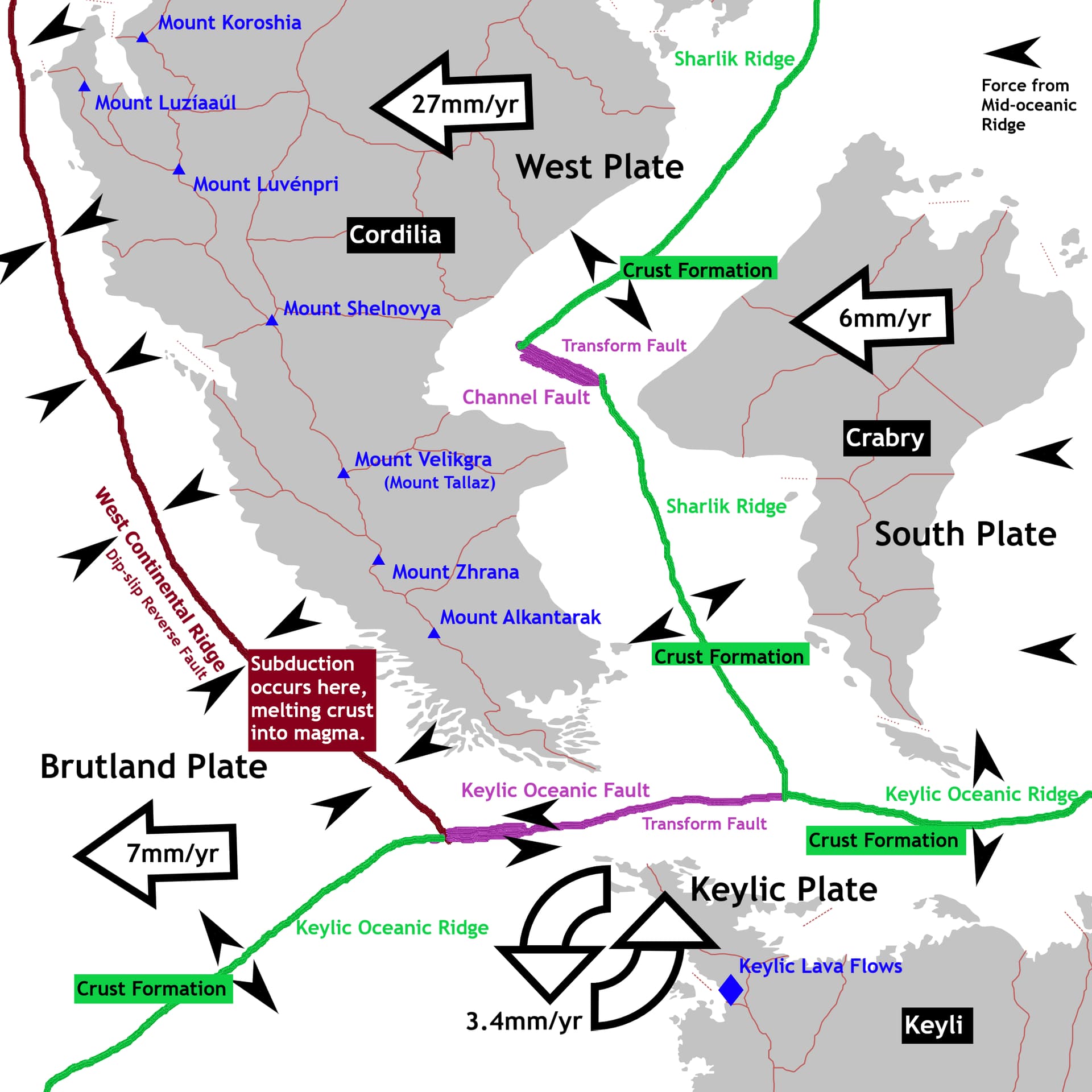
The Cordilian Peninsula lies at the convergence of four major tectonic plates: the West Plate, the Brutland Plate, the Keylic Plate, and the South Plate. This complex interplay of tectonic forces has made South Cordilia one of the most geologically dynamic regions on Pacifica.
Plate Movements and Subduction
-
West Plate: Moving at a rate of 27 millimeters per year, the West Plate is the fastest-moving tectonic plate on Pacifica. This rapid movement is driven by the Mid-Oceanic Ridge and Sharlik Ridge systems, which rapidly generate new crust and push the plate westward.
-
Brutland Plate: In contrast, the Brutland Plate moves at a much slower pace of 7 millimeters per year. This disparity in movement creates intense pressure along the West Continental Trench, where the West Plate subducts beneath the Brutland Plate. The subduction process generates frequent earthquakes and contributes to the formation of the region’s towering mountain ranges.
-
Keylic Plate and South Plate: The South Plate and Keylic Plate, though less influential in the region’s seismology, play a role in shaping the southern and eastern boundaries of the Cordilian Peninsula. Their interaction with the West Plate creates several minor fault lines and contributes to the region’s overall tectonic complexity.
Mountain Building
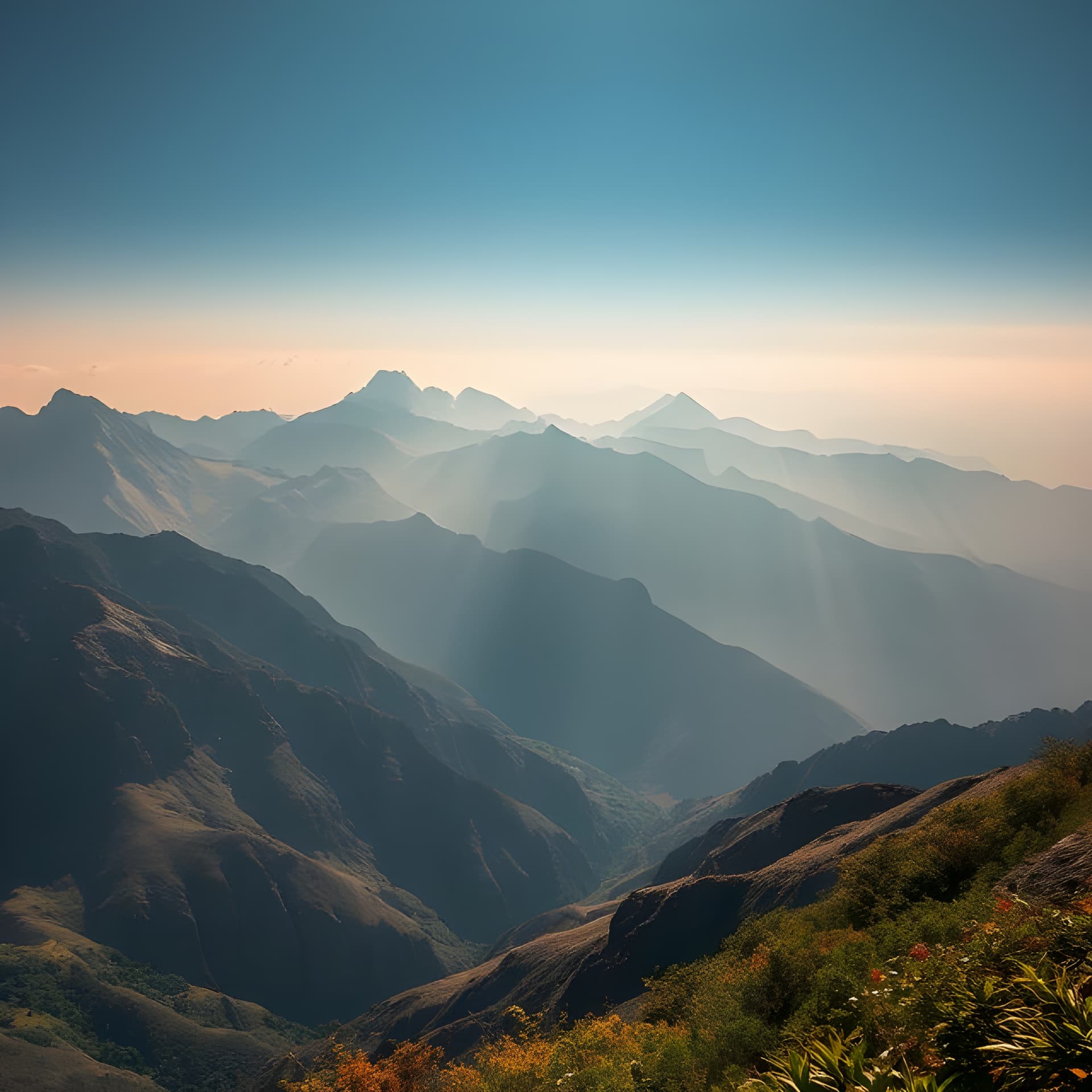
The collision of the West and Brutland Plates has given rise to Cordilia’s high peaks including the Luzayyagaz Mountain Range, which dominates the interior of the Cordilian Peninsula. This range was formed through a combination of tectonic uplift and volcanic activity, making it one of the most geologically dynamic regions on the continent. The Luzayyagaz Range is characterized by steep peaks, deep valleys, and active fault lines, which continue to shape the landscape through ongoing tectonic activity.
Northern Tectonic Phenomenon
In the northern parts of the West Plate, the migration rate slows to 20 millimeters per year, a phenomenon attributed to depressed volcanic activity along the northern Mid-Oceanic Ridge. This ridge, which bisects the South Pacific Ocean, plays a crucial role in regulating the movement of tectonic plates in the region. The slower movement in the north has resulted in less seismic activity compared to the southern regions, where the faster-moving West Plate collides with the Brutland Plate.
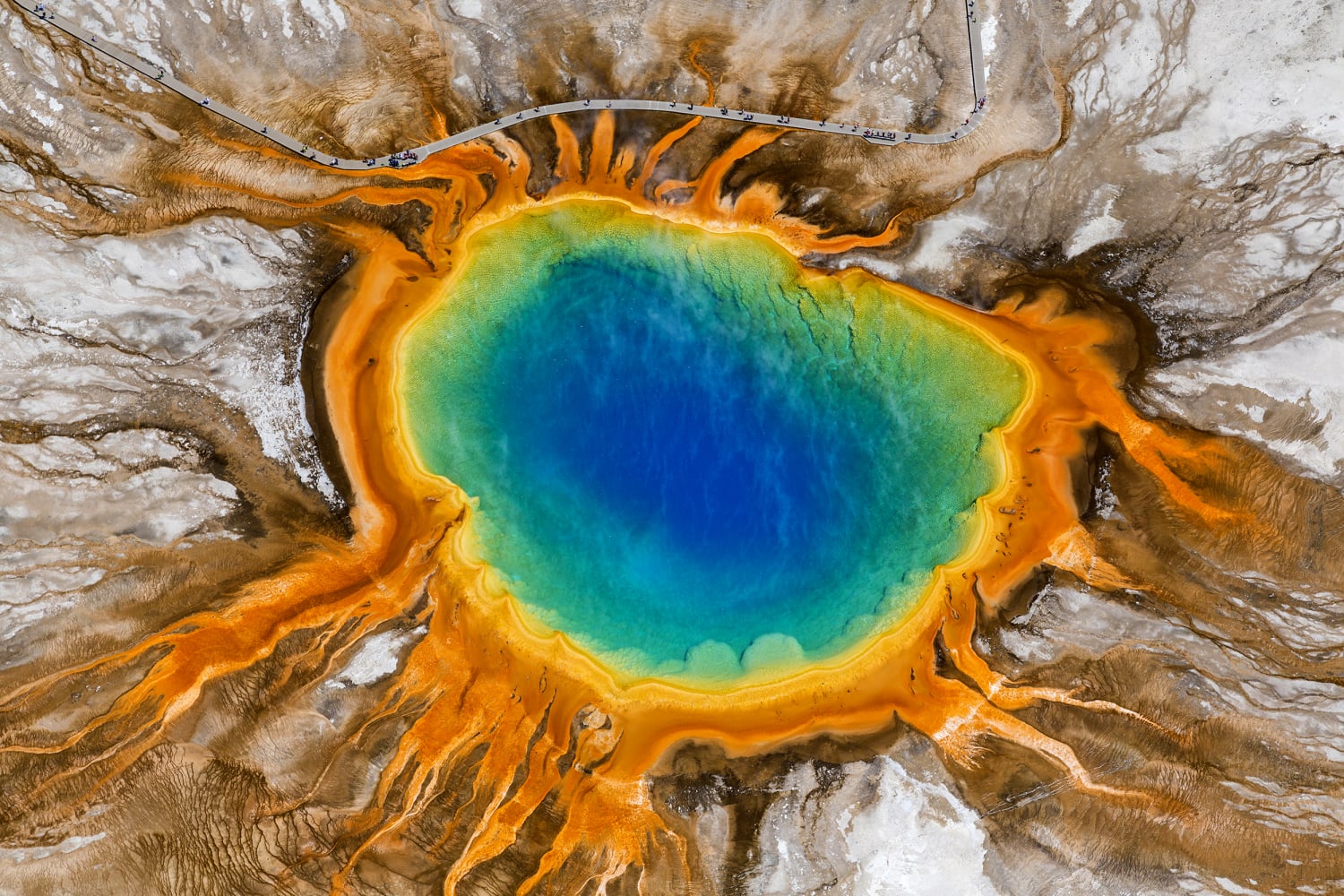
Volcanic Activity and the Cordilian Peninsula
The Cordilian Peninsula is home to some of the world’s largest and most active volcanoes, which are a direct result of the region’s tectonic activity. These volcanoes have shaped the landscape and influenced the lives of the people who call South Cordilia home.
Note: All placenames are KGS Standard
Major Volcanoes
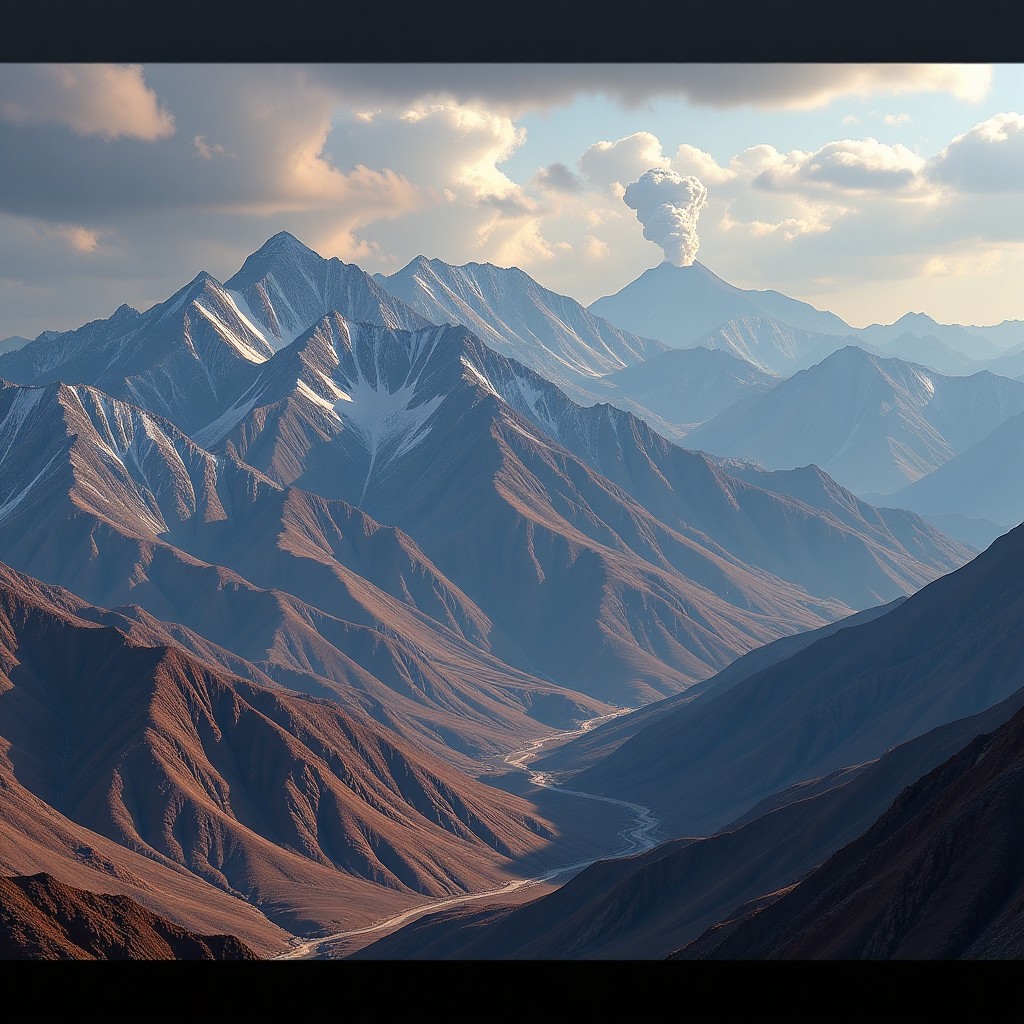
The lower peninsula is home to three of the world’s largest active volcanoes: Mount Velikgra, Mount Zhrana, and Mount Alkantarak. These volcanoes are part of the Luzayyagaz Volcanic Arc, a chain of seven volcanic peaks and the Keylic Lava Flows formed by the subduction of the West Plate beneath the Brutland Plate. The volcanic arc stretches along the western coast of the Cordilian Peninsula, creating a dramatic and geologically active landscape.
-
Mount Velikgra: Though its eruptions are infrequent geological records indicate the last major eruption of Mount Velikgra plunged much of the planet into a nuclear winter that lasted over two decades. Velikgra remains active and poses a significant risk to the region’s inhabitants. These hazards include lava flows, pyroclastic surges, ashfall, and lahars (volcanic mudflows).
-
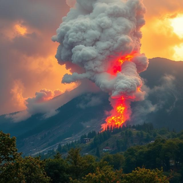
Mount Zhrana: Known for its frequent eruptions, Mount Zhrana is the most active volcano in the region. Its eruptions are characterized by pyroclastic flows and lava domes, which have reshaped the surrounding landscape over millennia. The last major eruption of Mount Zhrana occurred in 2381 BCE, a catastrophic event that destroyed nearby settlements and altered the climate due to massive ashfall. The eruption is still remembered in local folklore and serves as a reminder of the region’s volatile nature.
- Mount Alkantarak: This volcano is known for its abnormally large caldera, a large depression formed by the collapse of the volcano’s summit during its largest recorded eruption in 2691 BCE. Mount Alkantarak’s eruptions are less frequent but more explosive, posing significant risks to the surrounding areas and occurring generally on a 324-year cycle. The last recorded eruption took place in March of 821 CE, well over 1,200 years ago.

Volcanic Hazards
The active volcanoes of South Cordilia pose significant risks to the region’s inhabitants. These hazards include:
- Lava Flows: Molten rock that can destroy everything in its path.
- Pyroclastic Surges: Low-density, fast-moving currents of hot gas and volcanic material that can reach speeds of up to 700 kilometers per hour.
- Pyroclastic Flows: Pyroclastic flows are high-density currents of pumice, ash, blocks, and volcanic gas that rapidly move down the slopes of a volcano. These travel slightly slower than pyroclastic surges.
- Ashfall: Volcanic ash that can disrupt air travel and climate, damage crops, and cause respiratory problems.
- Lahars: Volcanic mudflows triggered by the melting of glacial ice during eruptions, which can devastate low-lying areas.
Seismic Activity and Earthquake Risks
The Cordilian Peninsula’s location on the West Continental Plate and its proximity to the West Continental Trench make it highly susceptible to earthquakes. The region experiences frequent seismic activity, ranging from minor tremors to devastating quakes.
Earthquake Frequency and Magnitude
South Cordilia is one of the most seismically active regions on Pacifica, with hundreds of earthquakes recorded each year. Most of these earthquakes are minor, with magnitudes below 4.0, but the region has also experienced several major quakes with magnitudes exceeding 7.0. These larger earthquakes often result in significant damage to infrastructure and loss of life.
Notable Earthquakes
-
745 CE: A magnitude 8.2 quake struck the Gulf of Good Omen, triggering a tsunami that inundated coastal settlements and disrupted trade routes for decades.
-
2691 BCE: The largest quake on record, with a magnitude 12.3, devastated the lower peninsula for over a century. The earthquake and ensuing tsunami caused widespread destruction and reshaped the coastline. This quake coincided with the largest recorded eruption of Mount Alkantarak on record.
Tsunami Risks
The subduction zone along the West Continental Trench poses a significant tsunami risk to the Gulf of Good Omen and the Cordilian Sea. Underwater earthquakes in this region can displace large volumes of water, generating tsunamis that can reach heights of 13 meters or more. Many coastal communities in South Cordilia have developed early warning systems and evacuation plans to mitigate the impact of these deadly waves.
Scientific Study and Disaster Preparedness
South Cordilia is home to several institutions dedicated to the study of seismology and volcanology. These organizations play a crucial role in monitoring seismic activity, predicting eruptions, and developing disaster preparedness strategies.
Research Institutions
-
Cordilian Institute of Geosciences: This leading research institution focuses on the study of tectonic activity, volcanic eruptions, and earthquake prediction. It uses advanced technologies, including seismographs, GIS networks, and satellite imagery, to monitor tectonic activity and provide early warnings of potential disasters.
-
Luzayyagaz Volcanic Observatory: Located near Mount Alkantarak, this observatory specializes in monitoring volcanic activity and studying the behavior of the region’s active volcanoes. Its research has contributed to the development of early warning systems and evacuation plans.
Disaster Preparedness Programs
Across most of South Cordilia comprehensive disaster preparedness programs to protect its population from earthquakes and volcanic eruptions have been implemented. These programs typically include public awareness & education campaigns, emergency drills, and the development of tsunami evacuation routes. Some regional governments also collaborate with international organizations to improve disaster response capabilities.
Environmental and Ecological Impact
The seismic and volcanic activity of South Cordilia has significant environmental and ecological consequences.
Landscape Changes
Earthquakes and volcanic eruptions have dramatically altered the landscape of South Cordilia over the millennia. The Luzayyagaz Mountain Range, for example, continues to grow as a result of tectonic uplift, while volcanic eruptions have created new geologic features, such as calderas and lava domes.
Marine Ecosystems
The Gulf of Good Omen and the Cordilian Sea are home to diverse marine ecosystems that are vulnerable to the effects of seismic activity. Underwater earthquakes can disrupt coral reefs and fish populations, while volcanic ashfall can alter water chemistry and harm marine life.
Scientific Study and Disaster Preparedness
South Cordilia is home to several institutions dedicated to the study of seismology and volcanology. These organizations play a crucial role in monitoring seismic activity, predicting eruptions, and developing disaster preparedness strategies.
The Cordilian Institute of Geosciences, and the Luzayyagaz Volcanic Observatory are at the forefront of seismic and volcanic research in the region. These institutions use advanced technologies, including seismographs, GIS networks, and satellite imagery to monitor tectonic activity and provide early warnings of potential disasters.
Across most of South Cordilia comprehensive disaster preparedness programs to protect its population from earthquakes and volcanic eruptions have been implemented. These programs typically include public awareness & education campaigns, emergency drills, and the development of tsunami evacuation routes. Some regional governments also collaborate with international organizations to improve disaster response capabilities.
Conclusion
The geology and seismology of South Cordilia are defined by constant tectonic activity and volcanic hazards. From the towering peaks of the Luzayyagaz Mountains to the fertile volcanic plains, the peninsula’s landscapes are a product of tectonic activity, volcanic eruptions, and erosional processes. Understanding these forces and their implications is essential for safeguarding the region’s population and ecosystems. While understanding the geology of South Cordilia is essential for managing its natural resources, mitigating geological hazards, and preserving its unique landscapes for future generations and wildlife.
References
Cordilian Institute of Geosciences. (2023). Annual Report on Seismic Activity in South Cordilia. Alkantara: Cordilian Press.
Luzayyagaz Volcanic Observatory. (2024). Volcanic Hazards and Risk Assessment in the Luzayyagaz Volcanic Arc. Luzayyagaz: Volcanic Studies Press.
Aliz, T. (1989). Tectonic Dynamics of the West Continental Plate. Pacifica Journal of Geosciences, pp.123-145.
Zuri, P. (2020). The Eruption of Mount Zhrana: A Historical and Geological Perspective. Journal of Cordilian History, pp. 67-89.
International Federation for Humanitarian Aid. (2020). Disaster Preparedness and Response in Seismically Active Regions. Grovne: IFHA Publications.
Krauanagaz Historical Society. (2011). The 2691 BCE Earthquake and Tsunami: A Case Study in Catastrophic Events. Krauanagaz: Historical Archives Press.