Plot customization request:
Type: Naming physical geographical features
Explanation (same text from consultations) for transparency and informing other users
-Disregard the formatting especially the sizes they were used to stress which name was referring to what
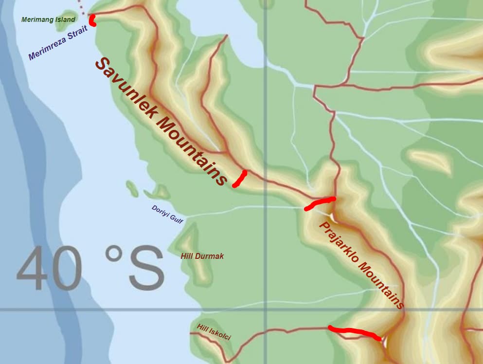
-If Savunlek and Prajarklo can’t be mountain (nor hill) ranges, can they be “Mounts” (Mt.) instead?
Explaining why:
-Prajarklo (Bregoderian: Pre-habitat, deep past, origin): Where evidence of Proto-Bregoder (Paleolithic) and Pre-Bregoder (Ancient) cultures originate from and were first noticed.
-Savunlek (Kretti: Defense medicine, guard save, good/angelic security): It’s the biggest land natural barrier to enter VN territory from, deducing that the population would have such a name for them.
-Hill Durmak (tur. “Stop”; Kretti: Barrier, Obstacle, Blocking): for separatign the two Zlarte and Halakhaos rivers, leading to Orchidae developing earlier and more isolated.
-Hill Iskolci (IRL Bregoderian and Kretti: “Irish, Gaelic, Scottish, Celtic”): I actually wasn’t aware it was so widely used for the Gaelic. Anyway, Tekar culture is Gaelic (IIRC).
-Merimeng Island (Bregoderian: Spider): where The CobWeb (as an actual Order and a Conspiracy) formed and are supposedly based at. (Long-term lore plan given that I think it’s the westernmost point of the map?).
-Merimreza Strait (Bregoderian: Spider-Web or Measure-Net): Natural barrier and safety for the Order to develop over the ages, also fishing net.
-Doriyi Gulf (IRL Bregoderian and Kretti hybrid: Good-good): The wealth of the area at least relative to overall territory and the end of Halakhaos river which already holds a “Holy” name.